Trail Walking Locquirec - Tour du Trégor morlaisien GR® 380 - GR® 34D: Locquirec - Plougasnou - Photo

Tour du Trégor morlaisien GR® 380 - GR® 34D: Locquirec - Plougasnou

 tracegps
tracegps

User

© OpenStreetMap contributors
Length
Length
16.6 km
Max alt
Max alt
74 m
Uphill gradient
Uphill gradient
458 m
Km-Effort
Km-Effort  
23 km
Min alt
Min alt
3 m
Downhill gradient
Downhill gradient
403 m
Boucle
Boucle
No
Creation date :
2014-12-10 00:00:00.0
Updated on :
2014-12-10 00:00:00.0

(0 Reviews)

Walking
Walking
4h00
Difficulty : Difficult

Scan this QR Code to open this trail in the SityTrail application

FREE GPS app for hiking

Logo SityTrail SityTrail

IGN / Geographical institutes

Download SityTrail from the App Store Download SityTrail from Google Play

Logo SityTrail SityTrail World

The world is yours!

Download SityTrail from the App Store Download SityTrail from Google Play Download SityTrail on Huawei AppGallery

About

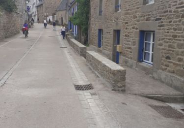
Trail Walking of 16.6 km to be discovered at Brittany, Finistère, Locquirec. This trail is proposed by tracegps.

Description

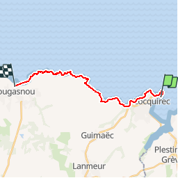
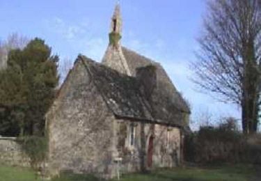
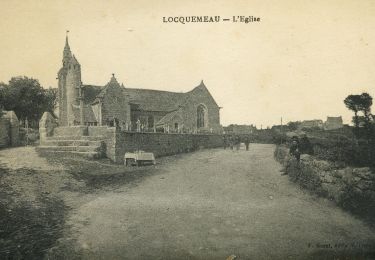
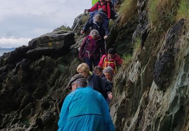
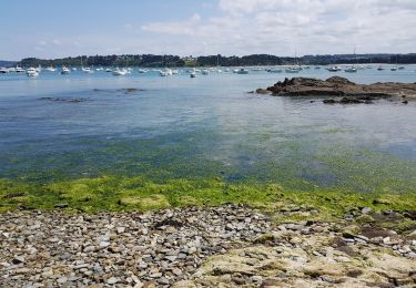
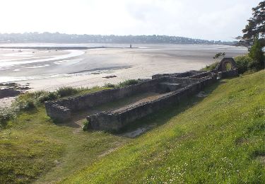
LE 22/04/09 - ATTENTION IMPORTANT COMMENTAIRE CI DESSOUS !!!! Tour du Trégor morlaisien GR® 380 - GR® 34D: Locquirec - Plougasnou Locquirec, ancienne station balnéaire gallo-romaine, église XIVème - XVème Vous trouverez le descriptif détaillé de cette randonnée dans le Topo-guide® de la Fédération Française de la Randonnée Pédestre. Le découpage proposé ici est donné à titre indicatif pour équilibrer la distance de chaque tronçon. Chacun peut l’adapter à son niveau. Pour toute information complémentaire sur la randonnée : Comité départemental du Finistère: 4 ROUTE DE ST RENAN BP 02 29810 PLOUARZEL Tél. : 0298896006

Elevation profile

Photos

Positioning

Country:
France
Region :
Brittany
Department/Province :
Finistère
Municipality :
Locquirec
Location:
Unknown
Start:(UTM)
452515 ; 5393460 (30U) N.

Trails nearby

Trail Mountain bike Plestin-les-Grèves - Circuit des chapelles, coté terre - Plestin-les-Grèves - Photo
Mountain bike
tracegps

Mountain bike

Medium
(1)
Plestin-les-Grèves, Brittany, Côtes-d'Armor, France
17.1 km | 20 km-effort
2h 0min
Yes
Trail Walking Guimaëc - Gr34 Poul Rodou à Venizella - Photo
Walking
Corto2023

Walking

Easy
Guimaëc, Brittany, Finistère, France
3.3 km | 4.3 km-effort
55min
No
Trail On foot Trédrez-Locquémeau - Circuit des Falaises de Trédrez - Photo
On foot
PRO

On foot

Easy
Trédrez-Locquémeau, Brittany, Côtes-d'Armor, France
11.2 km | 14.1 km-effort
3h 11min
Yes
Trail Walking Trédrez-Locquémeau - St Michelle tredrez - Photo
Walking
stephane Sandrine

Walking

Difficult
Trédrez-Locquémeau, Brittany, Côtes-d'Armor, France
6.5 km | 8.2 km-effort
1h 36min
No
Trail Walking Plestin-les-Grèves - Locquirec 07-06-19 - Photo
Walking
nolsim

Walking

Medium
Plestin-les-Grèves, Brittany, Côtes-d'Armor, France
12.4 km | 14.7 km-effort
3h 38min
No
Trail Walking Locquirec - lokirec - Photo
Walking

Walking

Very easy
Locquirec, Brittany, Finistère, France
4.6 km | 5.7 km-effort
1h 12min
Yes
Trail Walking Plestin-les-Grèves - Plestin les grèves - Photo
Walking
Marie-Claire-mcp

Walking

Medium
Plestin-les-Grèves, Brittany, Côtes-d'Armor, France
11.9 km | 14.7 km-effort
3h 10min
Yes
Trail Walking Plestin-les-Grèves - Embouchure du Douron - Plestin Les Grèves - Photo
Walking
tracegps

Walking

Medium
Plestin-les-Grèves, Brittany, Côtes-d'Armor, France
10.7 km | 12.9 km-effort
3h 0min
Yes
Trail Walking Plestin-les-Grèves - De Plestin Les Grèves à Saint Efflam - Photo
Walking
tracegps

Walking

Medium
(1)
Plestin-les-Grèves, Brittany, Côtes-d'Armor, France
10.7 km | 13.4 km-effort
4h 0min
Yes


Close
My subscriptions