


montee pas du Touet

verozerr
User
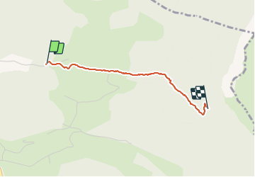

Length
2.1 km

Max alt
892 m

Uphill gradient
421 m
Km-Effort
6.3 km

Min alt
460 m

Downhill gradient
0 m
Boucle
No
Creation date :
2022-03-15 11:49:22.17
Updated on :
2022-03-15 13:13:29.088
1h23
Difficulty : Medium

FREE GPS app for hiking
 SityTrail
IGN / Geographical institutes
SityTrail Plus
The world is yours!
About
Trail Nordic walking of 2.1 km to be discovered at Auvergne-Rhône-Alpes, Drôme, Peyrus. This trail is proposed by verozerr.
Description
montee pas du Touet
Positioning
Country:
France
Region :
Auvergne-Rhône-Alpes
Department/Province :
Drôme
Municipality :
Peyrus
Location:
Unknown
Start:(Dec)
Start:(UTM)
667629 ; 4974765 (31T) N.
Comments