Trail Walking Chassiers - Balade à Largentière - Photo
 tracegps
tracegps

User

© OpenStreetMap contributors
Length
Length
4.7 km
Max alt
Max alt
319 m
Uphill gradient
Uphill gradient
124 m
Km-Effort
Km-Effort  
6.4 km
Min alt
Min alt
215 m
Downhill gradient
Downhill gradient
124 m
Boucle
Boucle
Yes
Creation date :
2014-12-10 00:00:00.0
Updated on :
2014-12-10 00:00:00.0

(0 Reviews)

Walking
Walking
45m
Difficulty : Medium

Scan this QR Code to open this trail in the SityTrail application

FREE GPS app for hiking

Logo SityTrail SityTrail

IGN / Geographical institutes

Download SityTrail from the App Store Download SityTrail from Google Play

Logo SityTrail SityTrail World

The world is yours!

Download SityTrail from the App Store Download SityTrail from Google Play Download SityTrail on Huawei AppGallery

About

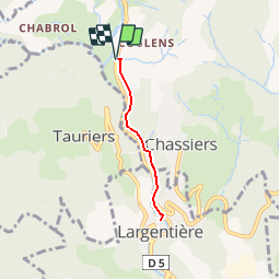
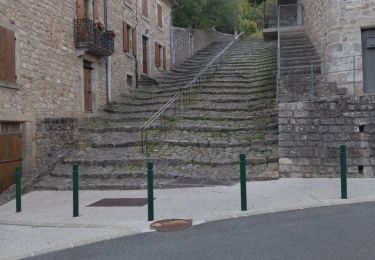
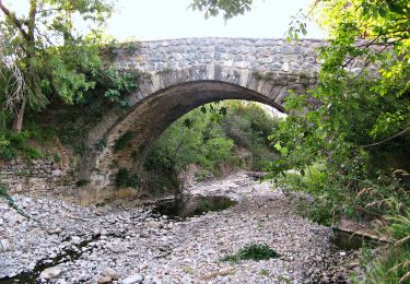
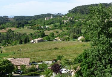
Trail Walking of 4.7 km to be discovered at Auvergne-Rhône-Alpes, Ardèche, Chassiers. This trail is proposed by tracegps.

Description

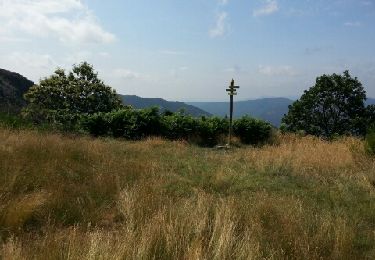
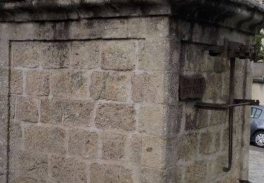
Très jolie randonnée familiale qui permet de découvrir un petit village typique de la région.

Elevation profile

Photos

Positioning

Country:
France
Region :
Auvergne-Rhône-Alpes
Department/Province :
Ardèche
Municipality :
Chassiers
Location:
Unknown
Start:(UTM)
602159 ; 4935009 (31T) N.

Trails nearby

Trail Mountain bike Joannas - roubreau col de bauzon  - Photo
Mountain bike
mouss65

Mountain bike

Very difficult
(1)
Joannas, Auvergne-Rhône-Alpes, Ardèche, France
65 km | 93 km-effort
6h 20min
Yes
Trail Walking Montréal - Le  chemin des Fades  Montréal  - Photo
Walking
Ptitjack30

Walking

Easy
(2)
Montréal, Auvergne-Rhône-Alpes, Ardèche, France
6.6 km | 9.3 km-effort
1h 51min
Yes
Trail Walking Montréal - 07_montreal_5-5km155m - Photo
Walking
SyMA

Walking

Easy
Montréal, Auvergne-Rhône-Alpes, Ardèche, France
5.6 km | 7.7 km-effort
1h 26min
Yes
Trail Walking Largentière - 07 largentiere joannas taurier - Photo
Walking
himba26100

Walking

Medium
Largentière, Auvergne-Rhône-Alpes, Ardèche, France
24 km | 36 km-effort
8h 40min
Yes
Trail On foot Largentière - Voie Verte de L'Argentière à Saint-Sernin - Photo
On foot
PRO

On foot

Easy
Largentière, Auvergne-Rhône-Alpes, Ardèche, France
12.7 km | 15.1 km-effort
3h 25min
No
Trail Walking Sanilhac - Sanilhac-Tour Brison-Versas 17km - Photo
Walking
GUIDE
thonyc

Walking

Medium
Sanilhac, Auvergne-Rhône-Alpes, Ardèche, France
16.5 km | 24 km-effort
5h 0min
Yes
Trail Walking Largentière - Le Tanargue en 2 jours - Photo
Walking
fashiondapulse

Walking

Very difficult
Largentière, Auvergne-Rhône-Alpes, Ardèche, France
65 km | 100 km-effort
15h 52min
No
Trail Walking Largentière - Tanargue - Photo
Walking
Cricounet84

Walking

Medium
(1)
Largentière, Auvergne-Rhône-Alpes, Ardèche, France
61 km | 97 km-effort
19h 47min
Yes
Trail Mountain bike Chassiers - vtt chassier - Photo
Mountain bike
mouss65

Mountain bike

Easy
Chassiers, Auvergne-Rhône-Alpes, Ardèche, France
11 km | 14 km-effort
1h 37min
Yes


Close
My subscriptions