Trail Cycle Wingles - Les parcs - Wingles - Photo
 tracegps
tracegps

User

© OpenStreetMap contributors
Length
Length
29 km
Max alt
Max alt
66 m
Uphill gradient
Uphill gradient
166 m
Km-Effort
Km-Effort  
31 km
Min alt
Min alt
16 m
Downhill gradient
Downhill gradient
166 m
Boucle
Boucle
Yes
Creation date :
2014-12-10 00:00:00.0
Updated on :
2014-12-10 00:00:00.0

(1 Reviews)

Cycle
Cycle
2h00
Difficulty : Easy

Scan this QR Code to open this trail in the SityTrail application

FREE GPS app for hiking

Logo SityTrail SityTrail

IGN / Geographical institutes

Download SityTrail from the App Store Download SityTrail from Google Play

Logo SityTrail SityTrail World

The world is yours!

Download SityTrail from the App Store Download SityTrail from Google Play Download SityTrail on Huawei AppGallery

About

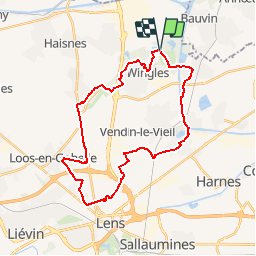
Trail Cycle of 29 km to be discovered at Hauts-de-France, Pas-de-Calais, Wingles. This trail is proposed by tracegps.

Description

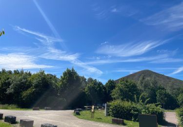
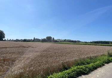
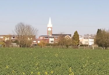
Départ du parc de nature et de loisirs, à l'entrée du centre nautique, chemin clair à Wingles. Il existe plusieurs autres points de départ pour ce circuit : Le parc des Cytises, route de La Bassée à Bénifontaine; Aire de loisirs des Faitelles, chemin de Béthune à Douai sur la commune de Vendin-le-Vieil. Il passe par les différents parcs au Nord de Lens. Retrouvez le circuit «Les Parcs» sur le site du conseil général du Pas-de-Calais.

Elevation profile

Photos

Positioning

Country:
France
Region :
Hauts-de-France
Department/Province :
Pas-de-Calais
Municipality :
Wingles
Location:
Unknown
Start:(UTM)
490545 ; 5594748 (31U) N.

Comments

Please log in to post a review or rate the element


Trails nearby

Trail Hybrid bike Wingles - Wingles parc de la souchez - Photo
Hybrid bike
yves62410

Hybrid bike

(1)
Wingles, Hauts-de-France, Pas-de-Calais, France
34 km | 36 km-effort
1h 53min
Yes
Trail Walking La Bassée - La Basée 13 km - Photo
Walking
GUIDE
rvapeldo

Walking

Easy
La Bassée, Hauts-de-France, Nord, France
13 km | 13.7 km-effort
3h 26min
Yes
Trail Walking Bauvin - Wingles - Photo
Walking
sandrine brisset

Walking

Medium
Bauvin, Hauts-de-France, Nord, France
11.8 km | 13 km-effort
3h 25min
No
Trail Electric bike Wingles - Wingles BÈthune vimy - Photo
Electric bike
yves62410

Electric bike

Medium
Wingles, Hauts-de-France, Pas-de-Calais, France
82 km | 92 km-effort
5h 32min
Yes
Trail Walking Haisnes - La gare - Haisnes - Photo
Walking
tracegps

Walking

Medium
Haisnes, Hauts-de-France, Pas-de-Calais, France
10.1 km | 10.8 km-effort
2h 30min
Yes
Trail Walking Billy-Berclau - Le chemin vert - Billy-Berclau - Photo
Walking
tracegps

Walking

Medium
Billy-Berclau, Hauts-de-France, Pas-de-Calais, France
9.2 km | 9.7 km-effort
2h 15min
Yes
Trail Walking Hantay - Circuit découverte nature des Weppes - Hantay - Photo
Walking
tracegps

Walking

Medium
(2)
Hantay, Hauts-de-France, Nord, France
9.2 km | 9.8 km-effort
2h 19min
Yes
Trail Electric bike Wingles - Vers Lorette  - Photo
Electric bike
yves62410

Electric bike

Easy
Wingles, Hauts-de-France, Pas-de-Calais, France
50 km | 55 km-effort
2h 49min
Yes
Trail Walking Billy-Berclau - Billy Berclau - Photo
Walking
roclem421

Walking

Easy
Billy-Berclau, Hauts-de-France, Pas-de-Calais, France
11.4 km | 12.4 km-effort
2h 29min
Yes


Close
My subscriptions