


la ferte imbault

lecmic
User
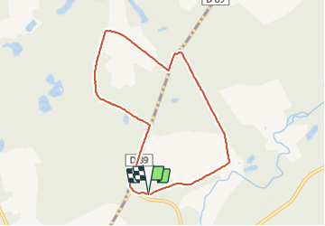

Length
7.7 km

Max alt
116 m

Uphill gradient
50 m
Km-Effort
8.3 km

Min alt
101 m

Downhill gradient
49 m
Boucle
Yes
Creation date :
2022-03-16 13:15:06.656
Updated on :
2022-03-16 15:14:52.426
1h58
Difficulty : Easy

FREE GPS app for hiking
 SityTrail
IGN / Geographical institutes
SityTrail Plus
The world is yours!
About
Trail Walking of 7.7 km to be discovered at Centre-Loire Valley, Loir-et-Cher, Salbris. This trail is proposed by lecmic.
Description
rando douce
Positioning
Country:
France
Region :
Centre-Loire Valley
Department/Province :
Loir-et-Cher
Municipality :
Salbris
Location:
Unknown
Start:(Dec)
Start:(UTM)
422770 ; 5251098 (31T) N.
Comments