Trail Walking Corscia - Monte Pinerole - Photo
 tracegps
tracegps

User

© OpenStreetMap contributors
Length
Length
7.8 km
Max alt
Max alt
1943 m
Uphill gradient
Uphill gradient
406 m
Km-Effort
Km-Effort  
13.2 km
Min alt
Min alt
1579 m
Downhill gradient
Downhill gradient
407 m
Boucle
Boucle
Yes
Creation date :
2014-12-10 00:00:00.0
Updated on :
2014-12-10 00:00:00.0

(0 Reviews)

Walking
Walking
4h00
Difficulty : Easy

Scan this QR Code to open this trail in the SityTrail application

FREE GPS app for hiking

Logo SityTrail SityTrail

IGN / Geographical institutes

Download SityTrail from the App Store Download SityTrail from Google Play

Logo SityTrail SityTrail World

The world is yours!

Download SityTrail from the App Store Download SityTrail from Google Play Download SityTrail on Huawei AppGallery

About

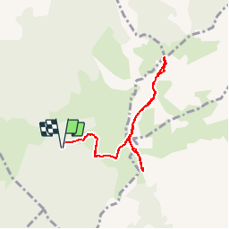
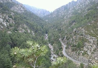
Trail Walking of 7.8 km to be discovered at Corsica, Haute-Corse, Corscia. This trail is proposed by tracegps.

Description

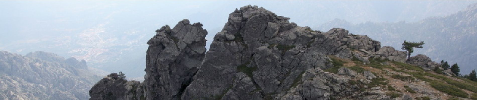
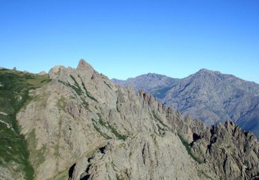
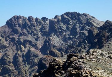
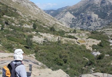
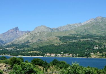
A proximité de Corte, Monte Pinerole offre un panorama particulièrement intéressant sur les reliefs encadrant les vallées de la Restonica, du Tavignano et du Golo, sans oublier la Castagniccia. Son accès depuis Corte ou ses environs est possible, mais exigeant avec des dénivelés positifs de l’ordre de 1500 mètres, et on peut même passer par « Arca di Scandulaghja » alias « Arche de Corte ». La randonnée proposée ici est en revanche très facile, avec moins de 500 mètres de dénivelé, y compris un petit complément : Punta Finosa. L’itinéraire n’est pour autant pas très fréquenté car il faut emprunter une piste de 16km environ (accessible en voiture ordinaire) au départ du barrage de Calacuccia... Plus de détails sur cette page

Elevation profile

Photos

Positioning

Country:
France
Region :
Corsica
Department/Province :
Haute-Corse
Municipality :
Corscia
Location:
Unknown
Start:(UTM)
506500 ; 4685654 (32T) N.

Comments

Please log in to post a review or rate the element


Ascension du Monte Pinérole par la forêt de pins lariccio de Forca. Le film du parcours: https://youtu.be/aiqdXebYyWg


Trails nearby

Trail Walking Corscia - Trek de Corscia à Castiglione en 4 jours - Photo
Walking
tracegps

Walking

Very difficult
(1)
Corscia, Corsica, Haute-Corse, France
31 km | 67 km-effort
30h 0min
No
Trail Walking Corte - restauniqua - Photo
Walking
Cathy del vecchio

Walking

Medium
Corte, Corsica, Haute-Corse, France
7.4 km | 11 km-effort
5h 20min
Yes
Trail Walking Corscia - Verdatu et Biancu - Trek de 4 jours - Photo
Walking
tracegps

Walking

Difficult
Corscia, Corsica, Haute-Corse, France
32 km | 70 km-effort
75h 0min
Yes
Trail Walking Casamaccioli - Punta Artica - Photo
Walking
tracegps

Walking

Difficult
Casamaccioli, Corsica, Haute-Corse, France
15.6 km | 28 km-effort
9h 30min
Yes
Trail Walking Casamaccioli - refuge de la Sega  - Photo
Walking
jeff2b

Walking

Medium
Casamaccioli, Corsica, Haute-Corse, France
14.7 km | 23 km-effort
4h 40min
Yes
Trail Walking Corte - GR® de Corse - Mare a Mare Nord - De A Sega à Albertacce - Photo
Walking
tracegps

Walking

Difficult
Corte, Corsica, Haute-Corse, France
12.3 km | 22 km-effort
5h 10min
No
Trail Walking Corte - Corse - Restonica - 2011-07-28 - Photo
Walking
Ticrob

Walking

Medium
(3)
Corte, Corsica, Haute-Corse, France
4.4 km | 7.4 km-effort
Unknown
No
Trail Walking Casamaccioli - Bocca a Croce =>Niño=>Sega - Photo
Walking
Lewuiss

Walking

Difficult
Casamaccioli, Corsica, Haute-Corse, France
28 km | 47 km-effort
8h 45min
Yes
Trail Walking Corte - Mare a mare Nord Boucle centre - Etape 11 - Refuge A Sega / Corte - Photo
Walking
zazie

Walking

Difficult
Corte, Corsica, Haute-Corse, France
13.4 km | 18.7 km-effort
4h 14min
No


Close
My subscriptions