Trail Walking Roquetoire - Sentier de la vallée - Roquetoire - Photo

Sentier de la vallée - Roquetoire

 tracegps
tracegps

User

© OpenStreetMap contributors
Length
Length
10 km
Max alt
Max alt
68 m
Uphill gradient
Uphill gradient
79 m
Km-Effort
Km-Effort  
11.1 km
Min alt
Min alt
22 m
Downhill gradient
Downhill gradient
80 m
Boucle
Boucle
Yes
Creation date :
2014-12-10 00:00:00.0
Updated on :
2014-12-10 00:00:00.0

(0 Reviews)

Walking
Walking
2h30
Difficulty : Medium

Scan this QR Code to open this trail in the SityTrail application

FREE GPS app for hiking

Logo SityTrail SityTrail

IGN / Geographical institutes

Download SityTrail from the App Store Download SityTrail from Google Play

Logo SityTrail SityTrail World

The world is yours!

Download SityTrail from the App Store Download SityTrail from Google Play Download SityTrail on Huawei AppGallery

About

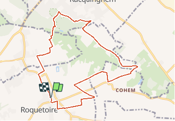
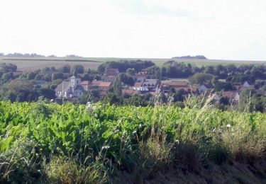
Trail Walking of 10 km to be discovered at Hauts-de-France, Pas-de-Calais, Roquetoire. This trail is proposed by tracegps.

Description

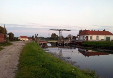
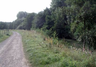
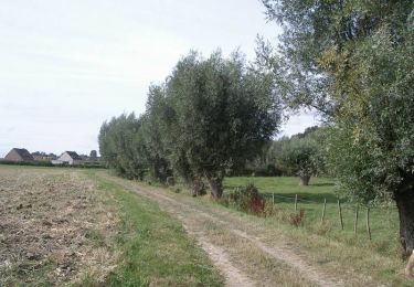
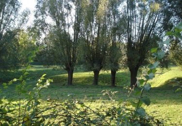
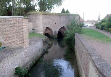
Départ de la mairie de Roquetoire. Vous prendrez le chemin vous conduisant à la vierge St-Amour, pour prendre ensuite la direction de Grand Quiestède, traverser la Melde pour rentrer dans le bois « Les Bruyères » de Racquinghem. A la sortie du bois, après un parcours en campagne, on retraverse la Melde pour revenir au point de départ. Retrouvez le circuit proposé par l'office de tourisme d'Aire-sur-la-Lys sur leur site.

Elevation profile

Photos

Positioning

Country:
France
Region :
Hauts-de-France
Department/Province :
Pas-de-Calais
Municipality :
Roquetoire
Location:
Unknown
Start:(UTM)
453504 ; 5613412 (31U) N.

Trails nearby

Trail Walking Aire-sur-la-Lys - Sentier entre Lys et Canal - Aire-sur-la-Lys - Photo
Walking
tracegps

Walking

Medium
(1)
Aire-sur-la-Lys, Hauts-de-France, Pas-de-Calais, France
10.5 km | 11.2 km-effort
2h 40min
Yes
Trail Walking Racquinghem - Sentier d'Hugo - Racquinghem - Photo
Walking
tracegps

Walking

Medium
Racquinghem, Hauts-de-France, Pas-de-Calais, France
10.4 km | 11.6 km-effort
2h 40min
Yes
Trail Walking Aire-sur-la-Lys - Sentier du Bruveau - Aire sur la Lys - Photo
Walking
tracegps

Walking

Medium
Aire-sur-la-Lys, Hauts-de-France, Pas-de-Calais, France
10.8 km | 11.7 km-effort
2h 40min
Yes
Trail Walking Roquetoire - Sentier des Héringaux  - Roquetoire - Photo
Walking
tracegps

Walking

Medium
Roquetoire, Hauts-de-France, Pas-de-Calais, France
13.6 km | 14.8 km-effort
3h 30min
Yes
Trail Walking Quiestède - Sentier de Laprée - Quiestède - Photo
Walking
tracegps

Walking

Easy
Quiestède, Hauts-de-France, Pas-de-Calais, France
6.5 km | 7 km-effort
1h 40min
Yes
Trail Walking Racquinghem - Deux jours de randonnée autour d'Aire sur la Lys - Etape 1 - Photo
Walking
tracegps

Walking

Difficult
Racquinghem, Hauts-de-France, Pas-de-Calais, France
24 km | 26 km-effort
6h 0min
No
Trail Walking Wittes - La Melde - Wittes - Photo
Walking
tracegps

Walking

Medium
Wittes, Hauts-de-France, Pas-de-Calais, France
9.4 km | 10.1 km-effort
2h 19min
Yes
Trail Walking Aire-sur-la-Lys - Le marais - Aire-sur-la-Lys - Photo
Walking
tracegps

Walking

Medium
Aire-sur-la-Lys, Hauts-de-France, Pas-de-Calais, France
9.4 km | 9.9 km-effort
2h 19min
Yes
Trail Walking Aire-sur-la-Lys - Promenade «à livres ouverts» à Aire sur la Lys - Photo
Walking
tracegps

Walking

Easy
Aire-sur-la-Lys, Hauts-de-France, Pas-de-Calais, France
2.8 km | 3 km-effort
1h 30min
Yes


Close
My subscriptions