Trail Walking Sauzet - Sentier de découverte du patrimoine de Sauzet - Photo

Sentier de découverte du patrimoine de Sauzet

 tracegps
tracegps

User

© OpenStreetMap contributors
Length
Length
3.4 km
Max alt
Max alt
350 m
Uphill gradient
Uphill gradient
138 m
Km-Effort
Km-Effort  
5.3 km
Min alt
Min alt
205 m
Downhill gradient
Downhill gradient
138 m
Boucle
Boucle
Yes
Creation date :
2014-12-10 00:00:00.0
Updated on :
2014-12-10 00:00:00.0

(0 Reviews)

Walking
Walking
1h30
Difficulty : Medium

Scan this QR Code to open this trail in the SityTrail application

FREE GPS app for hiking

Logo SityTrail SityTrail

IGN / Geographical institutes

Download SityTrail from the App Store Download SityTrail from Google Play

Logo SityTrail SityTrail World

The world is yours!

Download SityTrail from the App Store Download SityTrail from Google Play Download SityTrail on Huawei AppGallery

About

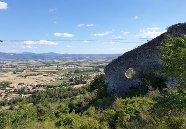
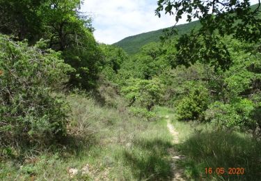
Trail Walking of 3.4 km to be discovered at Auvergne-Rhône-Alpes, Drôme, Sauzet. This trail is proposed by tracegps.

Description

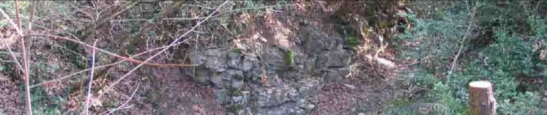
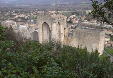
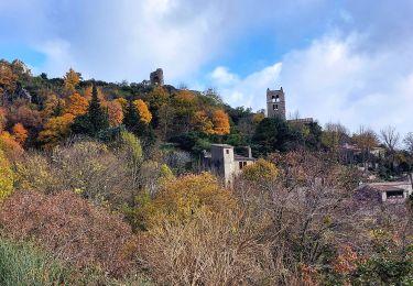
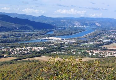
Ce sentier découverte a été réalisé par l'association Le Portalac de Sauzet. On y trouvera de nombreux panneaux indiquant les points caractéristiques à voir (carrières abandonnées, refuge pendant les bombardements, indications botaniques, paysages). Le sentier est tracé sur un site naturel avec un relief accidenté. Soyez vigilant, en particulier portez des chaussures adaptées. Ne vous écartez pas de l'itinéraire balisé (marques jaunes)

Elevation profile

Photos

Positioning

Country:
France
Region :
Auvergne-Rhône-Alpes
Department/Province :
Drôme
Municipality :
Sauzet
Location:
Unknown
Start:(UTM)
644605 ; 4941605 (31T) N.

Trails nearby

Trail Walking Cruas - 07 cruas st Vincent de barres - Photo
Walking
himba26100

Walking

Medium
(1)
Cruas, Auvergne-Rhône-Alpes, Ardèche, France
14.9 km | 25 km-effort
4h 23min
Yes
Trail Walking Marsanne - Marsanne Les Fileuses 11km - Photo
Walking
chancha

Walking

Difficult
Marsanne, Auvergne-Rhône-Alpes, Drôme, France
10 km | 14.5 km-effort
3h 17min
Yes
Trail Walking La Coucourde - La Coucourde : Alpion et Tas de Pierre 6km - Photo
Walking
chancha

Walking

Medium
La Coucourde, Auvergne-Rhône-Alpes, Drôme, France
6 km | 8.9 km-effort
2h 3min
Yes
Trail Walking Marsanne - 2022-09-27_14h01m03_14402824 - Photo
Walking
chancha

Walking

Very difficult
Marsanne, Auvergne-Rhône-Alpes, Drôme, France
23 km | 33 km-effort
7h 34min
Yes
Trail Walking Marsanne - 2022-09-27_13h58m49_14402807 - Photo
Walking
chancha

Walking

Medium
Marsanne, Auvergne-Rhône-Alpes, Drôme, France
4.4 km | 7.5 km-effort
1h 42min
Yes
Trail Walking Condillac - 2022-09-27_13h27m21_14402803 - Photo
Walking
chancha

Walking

Medium
Condillac, Auvergne-Rhône-Alpes, Drôme, France
7.2 km | 11.7 km-effort
2h 38min
Yes
Trail Walking Condillac - 2022-09-27_13h26m12_14402804 - Photo
Walking
chancha

Walking

Medium
Condillac, Auvergne-Rhône-Alpes, Drôme, France
10.6 km | 16.3 km-effort
3h 41min
Yes
Trail Walking La Laupie - 2022-09-27_13h22m54_14402800 - Photo
Walking
chancha

Walking

Easy
(1)
La Laupie, Auvergne-Rhône-Alpes, Drôme, France
6.7 km | 10.5 km-effort
2h 23min
Yes
Trail Walking Saint-Marcel-lès-Sauzet - 2022-09-27_13h20m15_14402792 - Photo
Walking
chancha

Walking

Easy
Saint-Marcel-lès-Sauzet, Auvergne-Rhône-Alpes, Drôme, France
6.3 km | 9 km-effort
2h 1min
Yes


Close
My subscriptions