


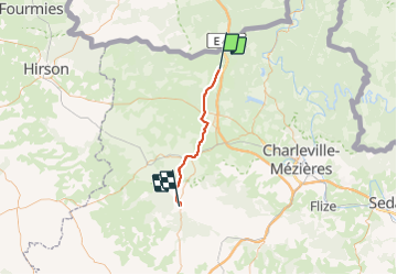
compo 2 Rocroi à Signy l'abbaye

BOUMA
User

Length
33 km

Max alt
387 m

Uphill gradient
456 m
Km-Effort
40 km

Min alt
137 m

Downhill gradient
704 m
Boucle
No
Creation date :
2022-03-17 08:17:04.281
Updated on :
2022-03-17 17:44:54.33
6h39
Difficulty : Difficult

FREE GPS app for hiking
 SityTrail
IGN / Geographical institutes
SityTrail Plus
The world is yours!
About
Trail Nordic walking of 33 km to be discovered at Grand Est, Ardennes, Rocroi. This trail is proposed by BOUMA.
Positioning
Country:
France
Region :
Grand Est
Department/Province :
Ardennes
Municipality :
Rocroi
Location:
Unknown
Start:(Dec)
Start:(UTM)
609109 ; 5530887 (31U) N.
Comments