Trail Walking Lagarde-Hachan - Le sentier du Bois du Cerf - Lagarde-Hachan - Photo

Le sentier du Bois du Cerf - Lagarde-Hachan

 tracegps
tracegps

User

© OpenStreetMap contributors
Length
Length
12.7 km
Max alt
Max alt
288 m
Uphill gradient
Uphill gradient
172 m
Km-Effort
Km-Effort  
15 km
Min alt
Min alt
207 m
Downhill gradient
Downhill gradient
172 m
Boucle
Boucle
Yes
Creation date :
2014-12-10 00:00:00.0
Updated on :
2014-12-10 00:00:00.0

(1 Reviews)

Walking
Walking
3h10
Difficulty : Medium

Scan this QR Code to open this trail in the SityTrail application

FREE GPS app for hiking

Logo SityTrail SityTrail

IGN / Geographical institutes

Download SityTrail from the App Store Download SityTrail from Google Play

Logo SityTrail SityTrail World

The world is yours!

Download SityTrail from the App Store Download SityTrail from Google Play Download SityTrail on Huawei AppGallery

About

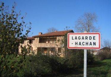
Trail Walking of 12.7 km to be discovered at Occitania, Gers, Lagarde-Hachan. This trail is proposed by tracegps.

Description

Circuit proposé par la Communauté de Communes Astarac Arros en Gascogne et l’Association Culture et Tradition en Astarac. Départ de la mairie de Lagarde-Hachan. Circuit sur des petites routes et chemins de campagne. Retrouvez le plan et le descriptif sur le site de la Communauté de Communes Astarac Arros en Gascogne.

Elevation profile

Photos

Positioning

Country:
France
Region :
Occitania
Department/Province :
Gers
Municipality :
Lagarde-Hachan
Location:
Unknown
Start:(UTM)
297067 ; 4809210 (31T) N.

Comments

Please log in to post a review or rate the element


Trails nearby

Trail Mountain bike Lagarde-Hachan - Le sentier du Bois du Cerf - Lagarde-Hachan - Photo
Mountain bike
tracegps

Mountain bike

Medium
Lagarde-Hachan, Occitania, Gers, France
12.7 km | 15 km-effort
1h 15min
Yes


Close
My subscriptions