


Ste Baume sentier de Vincent

bernir
User
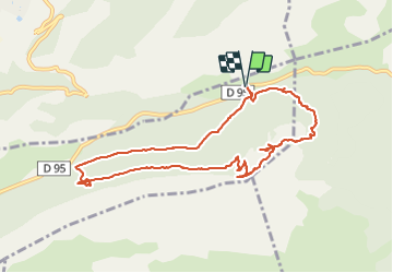

Length
11 km

Max alt
1034 m

Uphill gradient
437 m
Km-Effort
16.8 km

Min alt
725 m

Downhill gradient
436 m
Boucle
Yes
Creation date :
2022-03-17 08:26:25.295
Updated on :
2022-03-18 09:58:48.141
5h56
Difficulty : Medium

FREE GPS app for hiking
 SityTrail
IGN / Geographical institutes
SityTrail Plus
The world is yours!
About
Trail Walking of 11 km to be discovered at Provence-Alpes-Côte d'Azur, Var, Plan-d'Aups-Sainte-Baume. This trail is proposed by bernir.
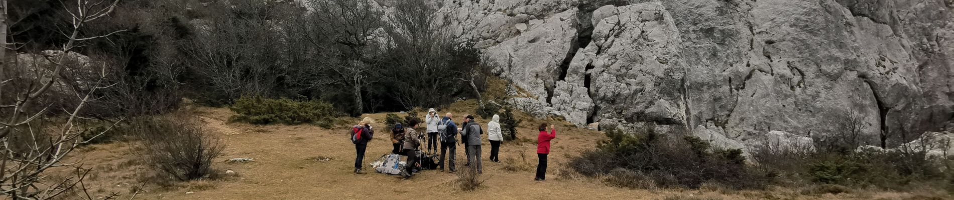
Photos


Positioning
Country:
France
Region :
Provence-Alpes-Côte d'Azur
Department/Province :
Var
Municipality :
Plan-d'Aups-Sainte-Baume
Location:
Unknown
Start:(Dec)
Start:(UTM)
728297 ; 4803589 (31T) N.
Comments