


chaud clapier

verozerr
User
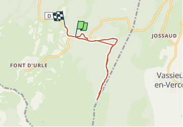

Length
6.6 km

Max alt
1521 m

Uphill gradient
260 m
Km-Effort
10 km

Min alt
1339 m

Downhill gradient
268 m
Boucle
No
Creation date :
2022-03-18 13:34:05.946
Updated on :
2022-03-18 15:47:17.917
2h12
Difficulty : Medium

FREE GPS app for hiking
 SityTrail
IGN / Geographical institutes
SityTrail Plus
The world is yours!
About
Trail Walking of 6.6 km to be discovered at Auvergne-Rhône-Alpes, Drôme, Bouvante. This trail is proposed by verozerr.
Description
rando chaud clapier
Positioning
Country:
France
Region :
Auvergne-Rhône-Alpes
Department/Province :
Drôme
Municipality :
Bouvante
Location:
Unknown
Start:(Dec)
Start:(UTM)
684549 ; 4975116 (31T) N.
Comments