Trail Walking Busnes - Le Béniau - Busnes - Photo
 tracegps
tracegps

User

© OpenStreetMap contributors
Length
Length
13 km
Max alt
Max alt
23 m
Uphill gradient
Uphill gradient
43 m
Km-Effort
Km-Effort  
13.6 km
Min alt
Min alt
15 m
Downhill gradient
Downhill gradient
43 m
Boucle
Boucle
Yes
Creation date :
2014-12-10 00:00:00.0
Updated on :
2014-12-10 00:00:00.0

(0 Reviews)

Walking
Walking
3h00
Difficulty : Medium

Scan this QR Code to open this trail in the SityTrail application

FREE GPS app for hiking

Logo SityTrail SityTrail

IGN / Geographical institutes

Download SityTrail from the App Store Download SityTrail from Google Play

Logo SityTrail SityTrail World

The world is yours!

Download SityTrail from the App Store Download SityTrail from Google Play Download SityTrail on Huawei AppGallery

About

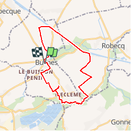
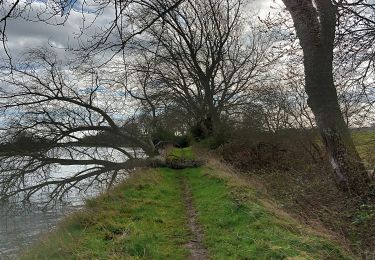
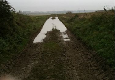
Trail Walking of 13 km to be discovered at Hauts-de-France, Pas-de-Calais, Busnes. This trail is proposed by tracegps.

Description

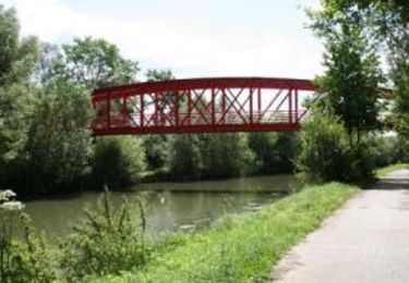
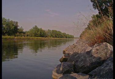
Quel beau dimanche ! Quelle belle randonnée ! Au départ de Busnes dont la spécialité est l'échalote, nous sillonnons les sentiers d'une campagne verdoyante à travers champs, suivons le canal d'Aire où nous croisons quelques péniches. Puis, nous empruntons le corridor écologique qui serpente le long de La Nave pour rejoindre notre point de départ. "Le béniau est un chariot à trois roues très utilisé dans les campagnes busnoises au milieu du siècle dernier". Retrouver le circuit sur le site de l'Office de Tourisme du Pays de la Lys Romane.

Elevation profile

Photos

Positioning

Country:
France
Region :
Hauts-de-France
Department/Province :
Pas-de-Calais
Municipality :
Busnes
Location:
Unknown
Start:(UTM)
465865 ; 5604036 (31U) N.

Trails nearby

Trail Other activity Saint-Venant - le_sentier_des_deux_ecluses - Photo
Other activity
LaHAL

Other activity

Medium
Saint-Venant, Hauts-de-France, Pas-de-Calais, France
12.5 km | 13 km-effort
Unknown
Yes
Trail Walking Guarbecque - 2015-08-24T22:07:05Z - Photo
Walking
samsam62

Walking

Very easy
(2)
Guarbecque, Hauts-de-France, Pas-de-Calais, France
38 km | 42 km-effort
9h 7min
Yes
Trail Walking Robecq - Sentier les tchiens - Robecq - Photo
Walking
tracegps

Walking

Medium
(1)
Robecq, Hauts-de-France, Pas-de-Calais, France
12 km | 12.7 km-effort
3h 0min
Yes
Trail Walking Busnes - Busnes et le canal d'aire. - Photo
Walking
BrassensJC

Walking

Medium
Busnes, Hauts-de-France, Pas-de-Calais, France
6.9 km | 7.2 km-effort
1h 38min
Yes
Trail Other activity Isbergues - 2010-11-20 - 10h10m01 - Photo
Other activity
djoulju

Other activity

Very easy
Isbergues, Hauts-de-France, Pas-de-Calais, France
23 km | 24 km-effort
Unknown
No
Trail Running Ham-en-Artois - course à pied Ham - Photo
Running
Ludovic Fort

Running

Easy
Ham-en-Artois, Hauts-de-France, Pas-de-Calais, France
11.5 km | 12.5 km-effort
1h 5min
Yes
Trail On foot Robecq - ROBECQ 12.7 km et 46m de déniv. - Photo
On foot
eaea7charles

On foot

Easy
Robecq, Hauts-de-France, Pas-de-Calais, France
12.8 km | 13.4 km-effort
3h 0min
Yes
Trail Walking Saint-Venant - saint VENANT - Photo
Walking
eaea7charles

Walking

Easy
Saint-Venant, Hauts-de-France, Pas-de-Calais, France
12.5 km | 13.1 km-effort
2h 55min
Yes
Trail On foot Gonnehem - Sir J2 - Photo
On foot
l.b62

On foot

Easy
Gonnehem, Hauts-de-France, Pas-de-Calais, France
5.6 km | 5.9 km-effort
1h 20min
Yes


Close
My subscriptions