


Kaiserstuhl Jechtingen

GR5 2020
User
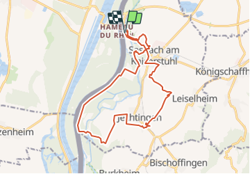

Length
17 km

Max alt
279 m

Uphill gradient
309 m
Km-Effort
21 km

Min alt
173 m

Downhill gradient
308 m
Boucle
Yes
Creation date :
2022-03-19 09:41:12.225
Updated on :
2022-03-19 16:59:57.952
3h50
Difficulty : Easy

FREE GPS app for hiking
 SityTrail
IGN / Geographical institutes
SityTrail Plus
The world is yours!
About
Trail On foot of 17 km to be discovered at Baden-Württemberg, Landkreis Emmendingen, Sasbach am Kaiserstuhl. This trail is proposed by GR5 2020.
Description
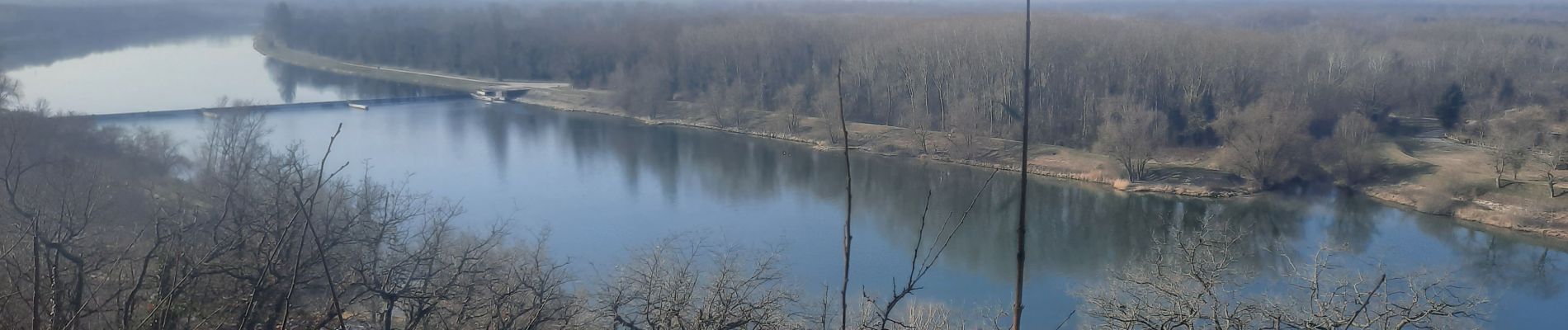
Départ parking du Limburg, montée à la ruine, chapelle et chemin de croix, étang Bad de Sasbach, digue du Rhin, Jechtingen et retour par le les vignes.
Photos

Positioning
Country:
Germany
Region :
Baden-Württemberg
Department/Province :
Landkreis Emmendingen
Municipality :
Sasbach am Kaiserstuhl
Location:
Unknown
Start:(Dec)
Start:(UTM)
395981 ; 5333633 (32U) N.
Comments