Trail Walking Roussillon - Roussillon 2013 - Photo
 tracegps
tracegps

User

© OpenStreetMap contributors
Length
Length
13.9 km
Max alt
Max alt
255 m
Uphill gradient
Uphill gradient
267 m
Km-Effort
Km-Effort  
17.5 km
Min alt
Min alt
174 m
Downhill gradient
Downhill gradient
264 m
Boucle
Boucle
Yes
Creation date :
2014-12-10 00:00:00.0
Updated on :
2014-12-10 00:00:00.0

(0 Reviews)

Walking
Walking
3h00
Difficulty : Easy

Scan this QR Code to open this trail in the SityTrail application

FREE GPS app for hiking

Logo SityTrail SityTrail

IGN / Geographical institutes

Download SityTrail from the App Store Download SityTrail from Google Play

Logo SityTrail SityTrail World

The world is yours!

Download SityTrail from the App Store Download SityTrail from Google Play Download SityTrail on Huawei AppGallery

About

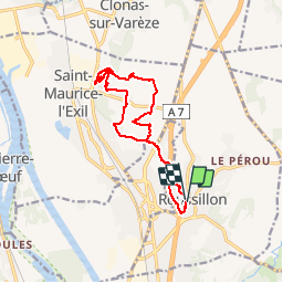
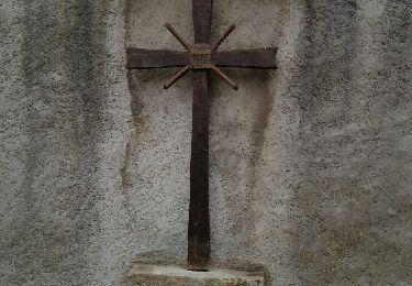
Trail Walking of 13.9 km to be discovered at Auvergne-Rhône-Alpes, Isère, Roussillon. This trail is proposed by tracegps.

Description

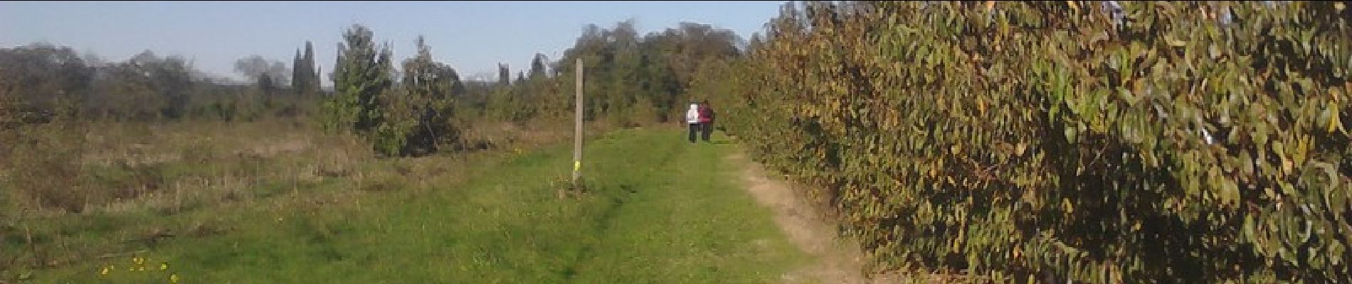
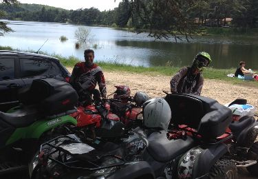
Rando familiale organisée par le vélo club.

Elevation profile

Photos

Positioning

Country:
France
Region :
Auvergne-Rhône-Alpes
Department/Province :
Isère
Municipality :
Roussillon
Location:
Unknown
Start:(UTM)
641786 ; 5026015 (31T) N.

Trails nearby

Trail On foot Assieu - Assieu - 11 km - 275 m de dénivelé - 3h30 - Photo
On foot
Clubléorando

On foot

Medium
(1)
Assieu, Auvergne-Rhône-Alpes, Isère, France
11 km | 14.7 km-effort
3h 30min
Yes
Trail Walking Saint-Pierre-de-Bœuf - 42-st-pierre-boeuf-malleval2-21km-480m - Photo
Walking
SyMA

Walking

Difficult
Saint-Pierre-de-Bœuf, Auvergne-Rhône-Alpes, Loire, France
21 km | 27 km-effort
5h 34min
Yes
Trail Walking Saint-Pierre-de-Bœuf - 42 St pierre de boeuf Veranne 20km 540m - Photo
Walking
SyMA

Walking

Easy
Saint-Pierre-de-Bœuf, Auvergne-Rhône-Alpes, Loire, France
20 km | 27 km-effort
5h 41min
Yes
Trail Walking Saint-Pierre-de-Bœuf - M-D janvier 2016  - Photo
Walking
bpc

Walking

Medium
Saint-Pierre-de-Bœuf, Auvergne-Rhône-Alpes, Loire, France
9.9 km | 13.8 km-effort
3h 9min
Yes
Trail Other activity Saint-Alban-du-Rhône - lac du ternay  - Photo
Other activity
control

Other activity

Easy
Saint-Alban-du-Rhône, Auvergne-Rhône-Alpes, Isère, France
61 km | 78 km-effort
4h 30min
Yes
Trail On foot Assieu - Assieu - 9,1 km - 209 m de dénivelé - 3h - Photo
On foot
Clubléorando

On foot

Easy
Assieu, Auvergne-Rhône-Alpes, Isère, France
9.1 km | 11.9 km-effort
3h 0min
Yes
Trail On foot Salaise-sur-Sanne - Le Péage de Roussillon - réserve naturelle Ile de la Platière - 10,6 km - 65 m de dénivelé - 3h - Photo
On foot
Clubléorando

On foot

Easy
Salaise-sur-Sanne, Auvergne-Rhône-Alpes, Isère, France
10.6 km | 11.4 km-effort
3h 0min
Yes
Trail On foot Saint-Pierre-de-Bœuf - St Pierre de Boeuf - 10,2 km - 278 m de dénivelé - 3h30 - Photo
On foot
Clubléorando

On foot

Medium
(1)
Saint-Pierre-de-Bœuf, Auvergne-Rhône-Alpes, Loire, France
10.2 km | 13.9 km-effort
3h 30min
Yes
Trail Walking Saint-Pierre-de-Bœuf - St Pierre de Boeuf - Photo
Walking
cousam

Walking

Medium
Saint-Pierre-de-Bœuf, Auvergne-Rhône-Alpes, Loire, France
22 km | 28 km-effort
6h 3min
Yes


Close
My subscriptions