Trail Walking Saint-Laurent-des-Arbres - Les Vignobles de Lirac  - Saint Laurent des Arbres - Photo

Les Vignobles de Lirac - Saint Laurent des Arbres

 tracegps
tracegps

User

© OpenStreetMap contributors
Length
Length
15.4 km
Max alt
Max alt
170 m
Uphill gradient
Uphill gradient
239 m
Km-Effort
Km-Effort  
18.6 km
Min alt
Min alt
64 m
Downhill gradient
Downhill gradient
242 m
Boucle
Boucle
Yes
Creation date :
2014-12-10 00:00:00.0
Updated on :
2014-12-10 00:00:00.0

(1 Reviews)

Walking
Walking
4h30
Difficulty : Difficult

Scan this QR Code to open this trail in the SityTrail application

FREE GPS app for hiking

Logo SityTrail SityTrail

IGN / Geographical institutes

Download SityTrail from the App Store Download SityTrail from Google Play

Logo SityTrail SityTrail World

The world is yours!

Download SityTrail from the App Store Download SityTrail from Google Play Download SityTrail on Huawei AppGallery

About

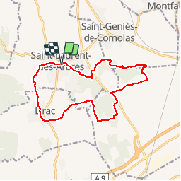
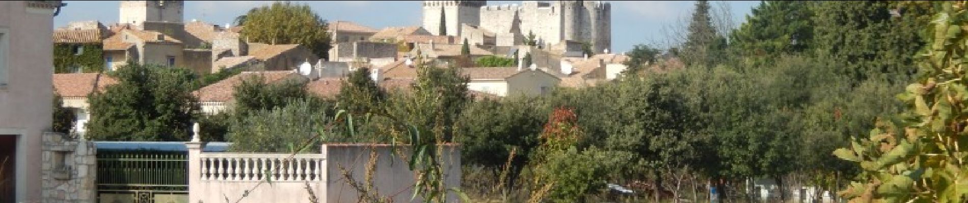
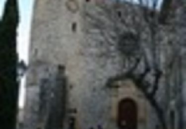
Trail Walking of 15.4 km to be discovered at Occitania, Gard, Saint-Laurent-des-Arbres. This trail is proposed by tracegps.

Description

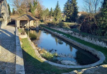
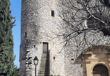
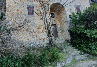
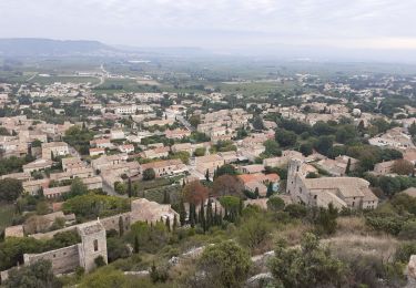
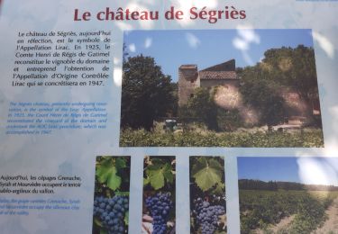
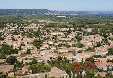
Parking à l'aire de jeux. Aller visiter le village et en sortir par la rue Marcel Pagnol puis le chemin de la Montagnette. La vue se dégage sur la vallée du Rhône et le Ventoux. Traverser Lirac puis remonter et traverser son vignoble avant de passer a la Croix des Gardes. Attention à la traversée de la N580 où l'on retrouve le GR qui nous guide parmi le vignoble. Le quitter pour gagner la montagne de Saint-Génies d'où la vue est splendide tout le long de la crête. Retourner au parking par le Sablas et le Moulin Neuf. Belle rando !

Elevation profile

Photos

Positioning

Country:
France
Region :
Occitania
Department/Province :
Gard
Municipality :
Saint-Laurent-des-Arbres
Location:
Unknown
Start:(UTM)
636161 ; 4879200 (31T) N.

Comments

Please log in to post a review or rate the element


Quelques parties dans les vignes dont clôturées, mais globalement le parcours est très agréable.


Trails nearby

Trail Walking Lirac - rando des 4 lavoirs  - Photo
Walking
GUIDE
nadinebondoux

Walking

Medium
Lirac, Occitania, Gard, France
21 km | 26 km-effort
5h 36min
Yes
Trail Walking Saint-Victor-la-Coste - Saint victor la coste 300323 - Photo
Walking
fario

Walking

Very difficult
Saint-Victor-la-Coste, Occitania, Gard, France
14.7 km | 19.4 km-effort
4h 24min
Yes
Trail Walking Lirac - Le Tanargue - Photo
Walking
MarcLEBARON

Walking

Medium
Lirac, Occitania, Gard, France
16.4 km | 22 km-effort
4h 34min
Yes
Trail Walking Saint-Victor-la-Coste - St Victor la Coste Goule de Navet - Photo
Walking
Manoune

Walking

Medium
Saint-Victor-la-Coste, Occitania, Gard, France
16.4 km | 22 km-effort
5h 47min
Yes
Trail Walking Saint-Laurent-des-Arbres - St Laurent des Arbres Montagne St Genies - Photo
Walking
Manoune

Walking

Medium
Saint-Laurent-des-Arbres, Occitania, Gard, France
18.8 km | 24 km-effort
6h 36min
Yes
Trail Walking Saint-Victor-la-Coste - Le Castellas de Saint Victor - Photo
Walking
SabetMick

Walking

Medium
Saint-Victor-la-Coste, Occitania, Gard, France
5.5 km | 7.5 km-effort
2h 31min
Yes
Trail Walking Saint-Victor-la-Coste - Le Goule de Navet -  St Victor la Coste - Photo
Walking
tracegps

Walking

Difficult
(1)
Saint-Victor-la-Coste, Occitania, Gard, France
13.7 km | 18.3 km-effort
4h 0min
Yes
Trail Walking Saint-Victor-la-Coste - 30 - SAINT-VICTOR-LA-COSTE – NAVET - 13.6Km - 05h15 - D 340 m - Photo
Walking
dansmabulle

Walking

Difficult
(1)
Saint-Victor-la-Coste, Occitania, Gard, France
13.6 km | 18.2 km-effort
3h 52min
Yes
Trail Walking Lirac - Lirac les 4 lavoirs - Photo
Walking
GUIDE
Roger Philippe Wallez

Walking

Very difficult
Lirac, Occitania, Gard, France
21 km | 26 km-effort
6h 39min
Yes


Close
My subscriptions