


St Claude

sameja
User
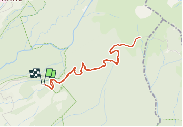

Length
6.9 km

Max alt
1151 m

Uphill gradient
382 m
Km-Effort
12 km

Min alt
746 m

Downhill gradient
390 m
Boucle
Yes
Creation date :
2022-03-20 10:18:47.0
Updated on :
2022-03-20 11:27:00.169
1h02
Difficulty : Medium

FREE GPS app for hiking
 SityTrail
IGN / Geographical institutes
SityTrail Plus
The world is yours!
About
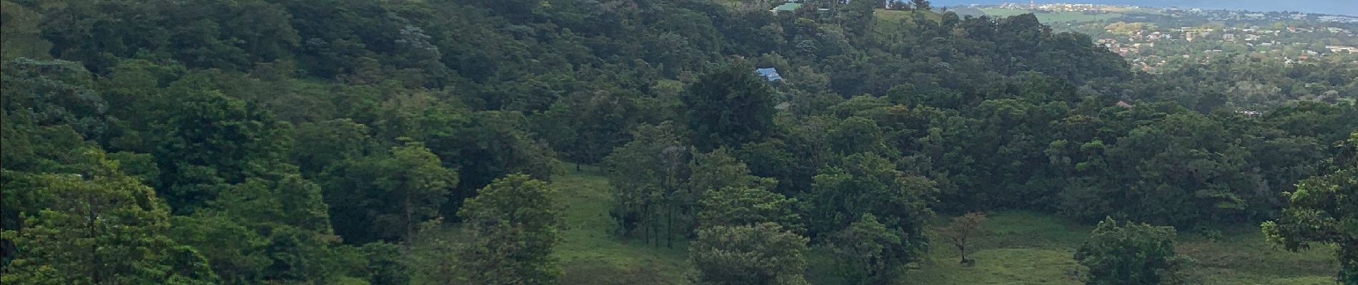
Trail Running of 6.9 km to be discovered at Guadeloupe, Unknown, Saint-Claude. This trail is proposed by sameja.
Description
Beausoleil
Photos


Positioning
Country:
France
Region :
Guadeloupe
Department/Province :
Unknown
Municipality :
Saint-Claude
Location:
Unknown
Start:(Dec)
Start:(UTM)
641159 ; 1772836 (20Q) N.
Comments