


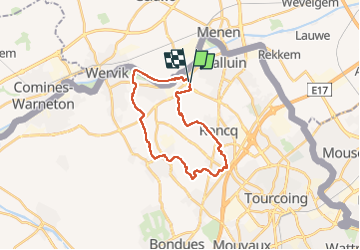
Environs de Bousbecque

Greg813
User


4h01
Difficulty : Easy

FREE GPS app for hiking
 SityTrail
IGN / Geographical institutes
SityTrail Plus
The world is yours!
About
Trail Walking of 21 km to be discovered at Hauts-de-France, Nord, Halluin. This trail is proposed by Greg813.
Description
Randonnée avec Mettons le Monde en Marche dans le nord du département du Nord passant par la ferme de Hautevalle (XVIIIè) jusqu'au suivi des rives de Lys formant la frontière franco-belge.
Pour d'autres photos, voir le site de l'association :
https://mmm-rando.org/bousbecque-2022/
Positioning
Comments