


2022 03 22 chemin halage jusqu'à pont Maris

hal2012
User

Length
28 km

Max alt
73 m

Uphill gradient
295 m
Km-Effort
32 km

Min alt
23 m

Downhill gradient
293 m
Boucle
Yes
Creation date :
2022-03-20 11:44:36.27
Updated on :
2022-03-20 14:35:11.421
2h50
Difficulty : Difficult

FREE GPS app for hiking
 SityTrail
IGN / Geographical institutes
SityTrail Plus
The world is yours!
About
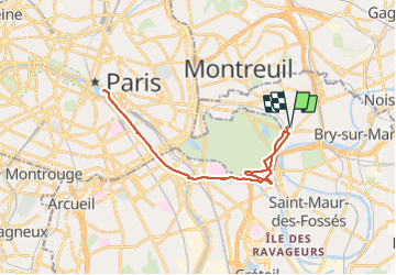
Trail Road bike of 28 km to be discovered at Ile-de-France, Val-de-Marne, Nogent-sur-Marne. This trail is proposed by hal2012.
Positioning
Country:
France
Region :
Ile-de-France
Department/Province :
Val-de-Marne
Municipality :
Nogent-sur-Marne
Location:
Unknown
Start:(Dec)
Start:(UTM)
461396 ; 5409578 (31U) N.
Comments