


fin 200322

verozerr
User

Length
3.1 km

Max alt
90 m

Uphill gradient
27 m
Km-Effort
3.4 km

Min alt
71 m

Downhill gradient
27 m
Boucle
No
Creation date :
2022-03-20 15:35:37.731
Updated on :
2022-03-20 15:56:26.536
20m
Difficulty : Easy

FREE GPS app for hiking
 SityTrail
IGN / Geographical institutes
SityTrail Plus
The world is yours!
About
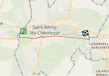
Trail Walking of 3.1 km to be discovered at Ile-de-France, Yvelines, Saint-Rémy-lès-Chevreuse. This trail is proposed by verozerr.
Positioning
Country:
France
Region :
Ile-de-France
Department/Province :
Yvelines
Municipality :
Saint-Rémy-lès-Chevreuse
Location:
Unknown
Start:(Dec)
Start:(UTM)
430579 ; 5394810 (31U) N.
Comments