


champvent

mcterret
User

Length
19.9 km

Max alt
393 m

Uphill gradient
485 m
Km-Effort
26 km

Min alt
220 m

Downhill gradient
515 m
Boucle
Yes
Creation date :
2022-03-21 09:34:14.129
Updated on :
2022-03-21 16:16:27.448
4h51
Difficulty : Medium

FREE GPS app for hiking
 SityTrail
IGN / Geographical institutes
SityTrail Plus
The world is yours!
About
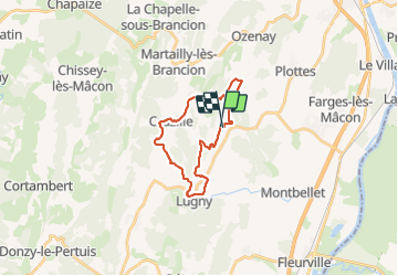
Trail Walking of 19.9 km to be discovered at Bourgogne-Franche-Comté, Saône-et-Loire, Chardonnay. This trail is proposed by mcterret.
Positioning
Country:
France
Region :
Bourgogne-Franche-Comté
Department/Province :
Saône-et-Loire
Municipality :
Chardonnay
Location:
Unknown
Start:(Dec)
Start:(UTM)
640250 ; 5151656 (31T) N.
Comments