


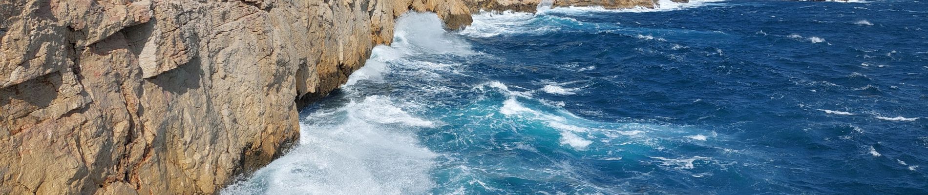
callelongue à les queyrons par la Galinette

ego
User
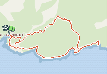

Length
7.5 km

Max alt
156 m

Uphill gradient
275 m
Km-Effort
11.2 km

Min alt
3 m

Downhill gradient
272 m
Boucle
Yes
Creation date :
2022-03-21 09:30:09.537
Updated on :
2022-03-21 18:00:59.68
6h03
Difficulty : Medium

FREE GPS app for hiking
 SityTrail
IGN / Geographical institutes
SityTrail Plus
The world is yours!
About
Trail Walking of 7.5 km to be discovered at Provence-Alpes-Côte d'Azur, Bouches-du-Rhône, Marseille. This trail is proposed by ego .
Photos


Positioning
Country:
France
Region :
Provence-Alpes-Côte d'Azur
Department/Province :
Bouches-du-Rhône
Municipality :
Marseille
Location:
8th Arrondissement
Start:(Dec)
Start:(UTM)
691178 ; 4787109 (31T) N.
Comments