


Bois bourgeois

Danielj
User
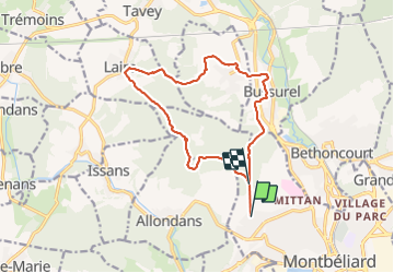

Length
13.7 km

Max alt
454 m

Uphill gradient
274 m
Km-Effort
17.3 km

Min alt
329 m

Downhill gradient
273 m
Boucle
No
Creation date :
2022-03-22 12:48:11.0
Updated on :
2022-03-22 16:29:37.502
3h38
Difficulty : Difficult

FREE GPS app for hiking
 SityTrail
IGN / Geographical institutes
SityTrail Plus
The world is yours!
About
Trail Walking of 13.7 km to be discovered at Bourgogne-Franche-Comté, Doubs, Montbéliard. This trail is proposed by Danielj.
Positioning
Country:
France
Region :
Bourgogne-Franche-Comté
Department/Province :
Doubs
Municipality :
Montbéliard
Location:
Unknown
Start:(Dec)
Start:(UTM)
332355 ; 5265333 (32T) N.
Comments