Trail Running Roncq - Courir autour de Roncq  - Photo

Courir autour de Roncq

 tracegps
tracegps

User

© OpenStreetMap contributors
Length
Length
10.4 km
Max alt
Max alt
47 m
Uphill gradient
Uphill gradient
67 m
Km-Effort
Km-Effort  
11.3 km
Min alt
Min alt
16 m
Downhill gradient
Downhill gradient
66 m
Boucle
Boucle
Yes
Creation date :
2014-12-10 00:00:00.0
Updated on :
2014-12-10 00:00:00.0

(0 Reviews)

Running
Running
1h00
Difficulty : Medium

Scan this QR Code to open this trail in the SityTrail application

FREE GPS app for hiking

Logo SityTrail SityTrail

IGN / Geographical institutes

Download SityTrail from the App Store Download SityTrail from Google Play

Logo SityTrail SityTrail World

The world is yours!

Download SityTrail from the App Store Download SityTrail from Google Play Download SityTrail on Huawei AppGallery

About

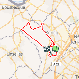
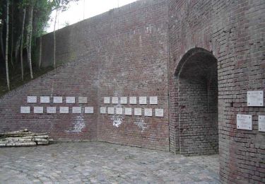
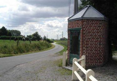
Trail Running of 10.4 km to be discovered at Hauts-de-France, Nord, Roncq. This trail is proposed by tracegps.

Description

Circuit de 10,4km pour course à pied. Le temps d'une heure correspond à l'obligation de donner un temps, il sera le temps que votre niveau vous permettra. Circuit sur route, trottoir, chemin piéton, parc. Parking pour vous garer dans un quartier calme avec un espace d'échauffement.

Elevation profile

Photos

Positioning

Country:
France
Region :
Hauts-de-France
Department/Province :
Nord
Municipality :
Roncq
Location:
Unknown
Start:(UTM)
508487 ; 5620552 (31U) N.

Trails nearby

Trail On foot Menin - Smokkelaarspad - Photo
On foot
PRO

On foot

Easy
Menin, Flanders, West Flanders, Belgium
10.3 km | 11.2 km-effort
2h 32min
Yes
Trail Mountain bike Roncq - De Roncq à la Lys en VTT - Photo
Mountain bike
tracegps

Mountain bike

Difficult
Roncq, Hauts-de-France, Nord, France
43 km | 47 km-effort
2h 30min
Yes
Trail Other activity Roncq - Voie verte et campagne - Roncq - Photo
Other activity
tracegps

Other activity

Difficult
Roncq, Hauts-de-France, Nord, France
17.2 km | 19 km-effort
2h 24min
Yes
Trail Walking Bondues - Au départ de Bondues - Photo
Walking
tracegps

Walking

Difficult
Bondues, Hauts-de-France, Nord, France
12.3 km | 13.4 km-effort
3h 4min
Yes
Trail Walking Linselles - Chapelles et Censes de Linselles - Photo
Walking
tracegps

Walking

Medium
(1)
Linselles, Hauts-de-France, Nord, France
13.4 km | 14.6 km-effort
3h 25min
Yes
Trail Walking Bousbecque - Circuit des Auger de Bousbecque - Photo
Walking
tracegps

Walking

Medium
(1)
Bousbecque, Hauts-de-France, Nord, France
13.3 km | 14.5 km-effort
3h 19min
Yes
Trail Walking Halluin - Boucle de la fraude du tabac - Halluin - Photo
Walking
tracegps

Walking

Medium
(2)
Halluin, Hauts-de-France, Nord, France
9.3 km | 10.1 km-effort
2h 19min
Yes
Trail Walking Roubaix - Roubaix 15 km  - Photo
Walking
GUIDE
rvapeldo

Walking

Very easy
Roubaix, Hauts-de-France, Nord, France
16 km | 17.5 km-effort
3h 51min
Yes
Trail Cycle Bondues - Le Ferrain - Bondues - Photo
Cycle
tracegps

Cycle

Medium
Bondues, Hauts-de-France, Nord, France
28 km | 31 km-effort
2h 0min
Yes


Close
My subscriptions