Trail Walking Saint-Martin-Boulogne - Sentier de la Colonne - Saint Martin Boulogne - Photo

Sentier de la Colonne - Saint Martin Boulogne

 tracegps
tracegps

User

© OpenStreetMap contributors
Length
Length
8.7 km
Max alt
Max alt
102 m
Uphill gradient
Uphill gradient
152 m
Km-Effort
Km-Effort  
10.8 km
Min alt
Min alt
38 m
Downhill gradient
Downhill gradient
152 m
Boucle
Boucle
Yes
Creation date :
2014-12-10 00:00:00.0
Updated on :
2014-12-10 00:00:00.0

(0 Reviews)

Walking
Walking
2h00
Difficulty : Easy

Scan this QR Code to open this trail in the SityTrail application

FREE GPS app for hiking

Logo SityTrail SityTrail

IGN / Geographical institutes

Download SityTrail from the App Store Download SityTrail from Google Play

Logo SityTrail SityTrail World

The world is yours!

Download SityTrail from the App Store Download SityTrail from Google Play Download SityTrail on Huawei AppGallery

About

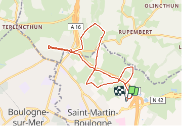
Trail Walking of 8.7 km to be discovered at Hauts-de-France, Pas-de-Calais, Saint-Martin-Boulogne. This trail is proposed by tracegps.

Description

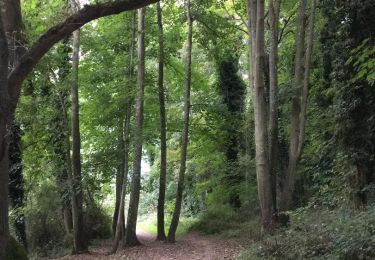
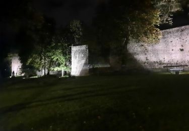
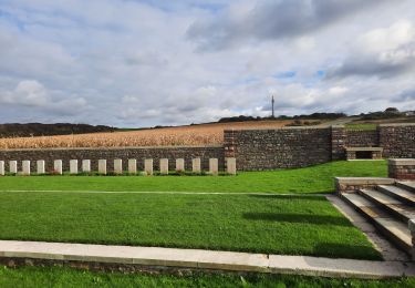
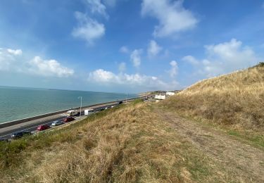
Départ du parking du magasin Decathlon, route de St-Omer, ZAC du Montjoie à St-Martin-Boulogne. Dans la vallée du Denacre se trouvent de très jolies demeures et manoirs du 19eme siècle, dont la plupart ont été construits en pierre de Baincthun. On y trouve également fermes, étangs ou encore cascades. Le circuit passe également au pied de la colonne de la Grande Armée, monument historique de 53 m de haut, fait de marbre et érigé à la gloire de Napoléon par les soldats du camp de Boulogne. Elle immortalise le camp où 180 000 hommes ont été rassemblés par l’Empereur pour préparer l’invasion de l’Angleterre. Retrouvez le circuit sur le site l’agglomération du Boulonnais.

Elevation profile

Photos

Positioning

Country:
France
Region :
Hauts-de-France
Department/Province :
Pas-de-Calais
Municipality :
Saint-Martin-Boulogne
Location:
Unknown
Start:(UTM)
404387 ; 5620597 (31U) N.

Trails nearby

Trail Walking Wimille - Balade sur le sentier du Denacre - Photo
Walking
GUIDE
Desrumaux

Walking

Very easy
(4)
Wimille, Hauts-de-France, Pas-de-Calais, France
9.8 km | 11.4 km-effort
2h 30min
Yes
Trail Mountain bike Wimereux - Le littoral de Wimereux à Etaples - Photo
Mountain bike
tracegps

Mountain bike

Medium
(1)
Wimereux, Hauts-de-France, Pas-de-Calais, France
35 km | 41 km-effort
3h 0min
No
Trail Walking Wimereux - Wimereux - La Crèche - Photo
Walking
tracegps

Walking

Medium
(4)
Wimereux, Hauts-de-France, Pas-de-Calais, France
9.3 km | 11.4 km-effort
2h 15min
Yes
Trail Walking Boulogne-sur-Mer - Boulogne sur mer- street art partiel  - Photo
Walking
GUIDE
blechanteur

Walking

Easy
Boulogne-sur-Mer, Hauts-de-France, Pas-de-Calais, France
4.9 km | 6 km-effort
1h 22min
No
Trail Walking Boulogne-sur-Mer - Boulogne sur mer,  les remparts de nuit  - Photo
Walking
GUIDE
blechanteur

Walking

Easy
Boulogne-sur-Mer, Hauts-de-France, Pas-de-Calais, France
2.4 km | 2.9 km-effort
51min
Yes
Trail Walking Wimereux - Boulogne-wimereux entre mer et terre  - Photo
Walking
GUIDE
blechanteur

Walking

Easy
Wimereux, Hauts-de-France, Pas-de-Calais, France
10.3 km | 12.5 km-effort
2h 42min
Yes
Trail Walking Wimereux - Wimereux Boulogne - Photo
Walking
FOUCAULT

Walking

Wimereux, Hauts-de-France, Pas-de-Calais, France
8.1 km | 10.1 km-effort
2h 35min
Yes
Trail Walking Boulogne-sur-Mer - Boulogne sur Mer - Photo
Walking
FOUCAULT

Walking

Boulogne-sur-Mer, Hauts-de-France, Pas-de-Calais, France
7 km | 8.1 km-effort
2h 8min
No
Trail Walking Baincthun - Sentier de la Pierre de Baincthun - Photo
Walking
tracegps

Walking

Easy
(1)
Baincthun, Hauts-de-France, Pas-de-Calais, France
4 km | 5.2 km-effort
1h 19min
Yes


Close
My subscriptions