


sauve. mer rochers.03.22

NADINE52
User
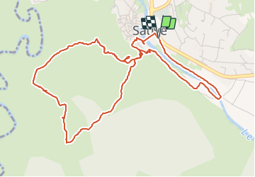

Length
6.7 km

Max alt
154 m

Uphill gradient
110 m
Km-Effort
8.2 km

Min alt
90 m

Downhill gradient
111 m
Boucle
Yes
Creation date :
2022-03-24 10:46:38.652
Updated on :
2022-03-24 14:37:02.831
2h06
Difficulty : Medium

FREE GPS app for hiking
 SityTrail
IGN / Geographical institutes
SityTrail Plus
The world is yours!
About
Trail Walking of 6.7 km to be discovered at Occitania, Gard, Sauve. This trail is proposed by NADINE52.
Positioning
Country:
France
Region :
Occitania
Department/Province :
Gard
Municipality :
Sauve
Location:
Unknown
Start:(Dec)
Start:(UTM)
576439 ; 4865641 (31T) N.
Comments