


izeron

Liebeaux
User

Length
19.7 km

Max alt
971 m

Uphill gradient
900 m
Km-Effort
32 km

Min alt
242 m

Downhill gradient
897 m
Boucle
Yes
Creation date :
2022-03-24 08:03:14.755
Updated on :
2022-03-24 14:46:18.495
6h41
Difficulty : Very difficult

FREE GPS app for hiking
 SityTrail
IGN / Geographical institutes
SityTrail Plus
The world is yours!
About
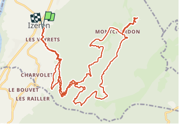
Trail Walking of 19.7 km to be discovered at Auvergne-Rhône-Alpes, Isère, Izeron. This trail is proposed by Liebeaux.
Positioning
Country:
France
Region :
Auvergne-Rhône-Alpes
Department/Province :
Isère
Municipality :
Izeron
Location:
Unknown
Start:(Dec)
Start:(UTM)
686822 ; 5001977 (31T) N.
Comments