


Chalets de Clapeyto

lionelnottat
User
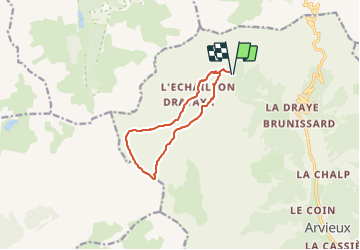

Length
10.2 km

Max alt
2539 m

Uphill gradient
604 m
Km-Effort
18.3 km

Min alt
1968 m

Downhill gradient
596 m
Boucle
Yes
Creation date :
2022-03-25 10:59:21.263
Updated on :
2022-03-25 10:59:55.912
4h08
Difficulty : Difficult

FREE GPS app for hiking
 SityTrail
IGN / Geographical institutes
SityTrail Plus
The world is yours!
About
Trail Walking of 10.2 km to be discovered at Provence-Alpes-Côte d'Azur, Hautes-Alpes, Arvieux. This trail is proposed by lionelnottat.
Positioning
Country:
France
Region :
Provence-Alpes-Côte d'Azur
Department/Province :
Hautes-Alpes
Municipality :
Arvieux
Location:
Unknown
Start:(Dec)
Start:(UTM)
318657 ; 4963914 (32T) N.
Comments