


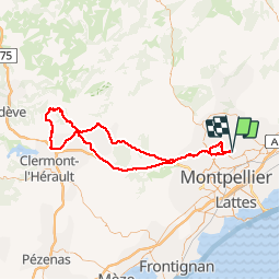
clapiers-st jean de la blaquière

ARVIEU
User

Length
109 km

Max alt
517 m

Uphill gradient
1644 m
Km-Effort
131 km

Min alt
40 m

Downhill gradient
1638 m
Boucle
No
Creation date :
2014-12-10 00:00:00.0
Updated on :
2014-12-10 00:00:00.0
5h00
Difficulty : Medium

FREE GPS app for hiking
 SityTrail
IGN / Geographical institutes
SityTrail Plus
The world is yours!
About
Trail Cycle of 109 km to be discovered at Occitania, Hérault, Clapiers. This trail is proposed by ARVIEU.
Description
par Arboras
Positioning
Country:
France
Region :
Occitania
Department/Province :
Hérault
Municipality :
Clapiers
Location:
Unknown
Start:(Dec)
Start:(UTM)
571954 ; 4834098 (31T) N.
Comments