Randonnée du 09/10/2021 à 09:57

houbart
User

Length
14.5 km

Max alt
345 m

Uphill gradient
466 m
Km-Effort
21 km

Min alt
129 m

Downhill gradient
465 m
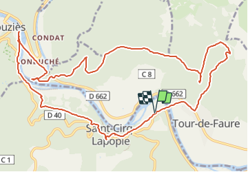
Boucle
Yes
Creation date :
2022-03-27 18:56:44.234
Updated on :
2022-03-31 14:38:23.931
4h42
Difficulty : Very difficult

FREE GPS app for hiking
 SityTrail
IGN / Geographical institutes
SityTrail Plus
The world is yours!
About
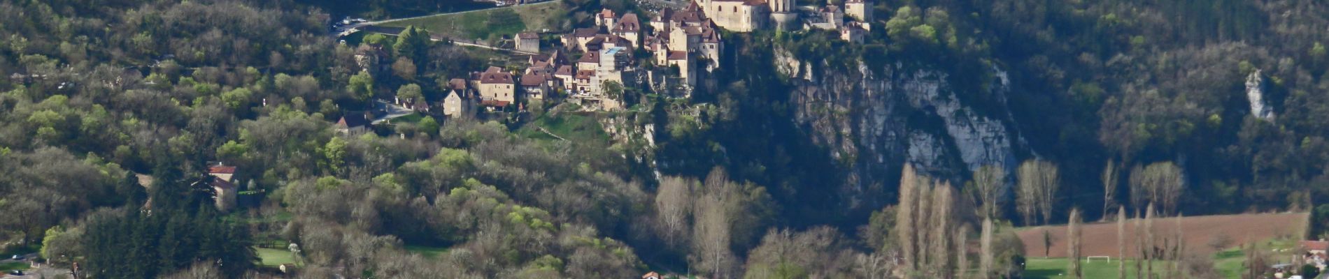
Trail Walking of 14.5 km to be discovered at Occitania, Lot, Saint-Cirq-Lapopie. This trail is proposed by houbart.
Photos


Positioning
Country:
France
Region :
Occitania
Department/Province :
Lot
Municipality :
Saint-Cirq-Lapopie
Location:
Unknown
Start:(Dec)
Start:(UTM)
394988 ; 4924775 (31T) N.
Comments