


Les Jas de Chateau-neuf-Val-St-Donat

Clo0413
User

Length
14.1 km

Max alt
1201 m

Uphill gradient
644 m
Km-Effort
23 km

Min alt
614 m

Downhill gradient
644 m
Boucle
Yes
Creation date :
2022-03-28 07:21:37.342
Updated on :
2022-04-01 16:58:19.835
4h13
Difficulty : Medium

FREE GPS app for hiking
 SityTrail
IGN / Geographical institutes
SityTrail Plus
The world is yours!
About
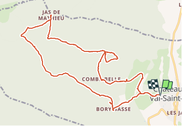
Trail Walking of 14.1 km to be discovered at Provence-Alpes-Côte d'Azur, Alpes-de-Haute-Provence, Châteauneuf-Val-Saint-Donat. This trail is proposed by Clo0413.
Positioning
Country:
France
Region :
Provence-Alpes-Côte d'Azur
Department/Province :
Alpes-de-Haute-Provence
Municipality :
Châteauneuf-Val-Saint-Donat
Location:
Unknown
Start:(Dec)
Start:(UTM)
735612 ; 4886362 (31T) N.
Comments