


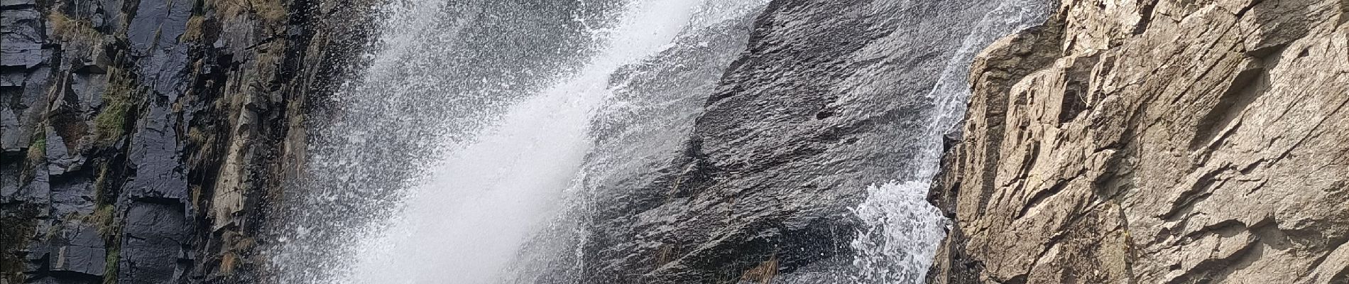
roquefer

bouscaillou
User

Length
18.9 km

Max alt
799 m

Uphill gradient
748 m
Km-Effort
29 km

Min alt
310 m

Downhill gradient
747 m
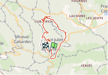
Boucle
Yes
Creation date :
2022-03-28 07:52:27.699
Updated on :
2022-03-28 14:30:24.607
6h37
Difficulty : Very difficult

FREE GPS app for hiking
 SityTrail
IGN / Geographical institutes
SityTrail Plus
The world is yours!
About
Trail Walking of 18.9 km to be discovered at Occitania, Aude, Roquefère. This trail is proposed by bouscaillou.
Photos

Positioning
Country:
France
Region :
Occitania
Department/Province :
Aude
Municipality :
Roquefère
Location:
Unknown
Start:(Dec)
Start:(UTM)
449566 ; 4802246 (31T) N.
Comments