


Mont - Loudenvielle

zazibelle
User
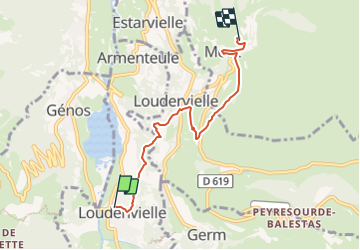

Length
5.3 km

Max alt
1388 m

Uphill gradient
479 m
Km-Effort
10.3 km

Min alt
965 m

Downhill gradient
64 m
Boucle
No
Creation date :
2022-03-28 13:06:23.416
Updated on :
2022-03-29 19:54:11.76
2h00
Difficulty : Easy

FREE GPS app for hiking
 SityTrail
IGN / Geographical institutes
SityTrail Plus
The world is yours!
About
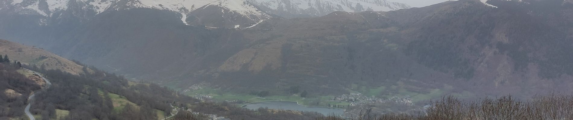
Trail Walking of 5.3 km to be discovered at Occitania, Hautespyrenees, Loudenvielle. This trail is proposed by zazibelle.
Photos

Positioning
Country:
France
Region :
Occitania
Department/Province :
Hautespyrenees
Municipality :
Loudenvielle
Location:
Loudenvielle
Start:(Dec)
Start:(UTM)
288178 ; 4741479 (31T) N.
Comments