


Château guirbarden

remysimon
User
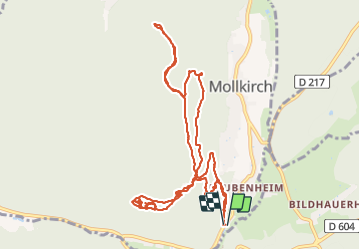

Length
12.3 km

Max alt
572 m

Uphill gradient
377 m
Km-Effort
17.3 km

Min alt
320 m

Downhill gradient
370 m
Boucle
Yes
Creation date :
2022-03-29 08:25:36.0
Updated on :
2022-03-29 13:54:51.755
3h41
Difficulty : Difficult

FREE GPS app for hiking
 SityTrail
IGN / Geographical institutes
SityTrail Plus
The world is yours!
About
Trail Walking of 12.3 km to be discovered at Grand Est, Bas-Rhin, Mollkirch. This trail is proposed by remysimon.
Photos


Positioning
Country:
France
Region :
Grand Est
Department/Province :
Bas-Rhin
Municipality :
Mollkirch
Location:
Unknown
Start:(Dec)
Start:(UTM)
380581 ; 5372169 (32U) N.
Comments