


taurize

Mascart
User
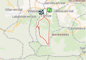

Length
9.2 km

Max alt
588 m

Uphill gradient
368 m
Km-Effort
14.1 km

Min alt
232 m

Downhill gradient
370 m
Boucle
No
Creation date :
2022-03-29 11:48:13.633
Updated on :
2022-03-29 20:43:27.088
4h22
Difficulty : Medium

FREE GPS app for hiking
 SityTrail
IGN / Geographical institutes
SityTrail Plus
The world is yours!
About
Trail Walking of 9.2 km to be discovered at Occitania, Aude, Taurize. This trail is proposed by Mascart.
Description
par le pic de Caousses
Positioning
Country:
France
Region :
Occitania
Department/Province :
Aude
Municipality :
Taurize
Location:
Unknown
Start:(Dec)
Start:(UTM)
459716 ; 4769448 (31T) N.
Comments