


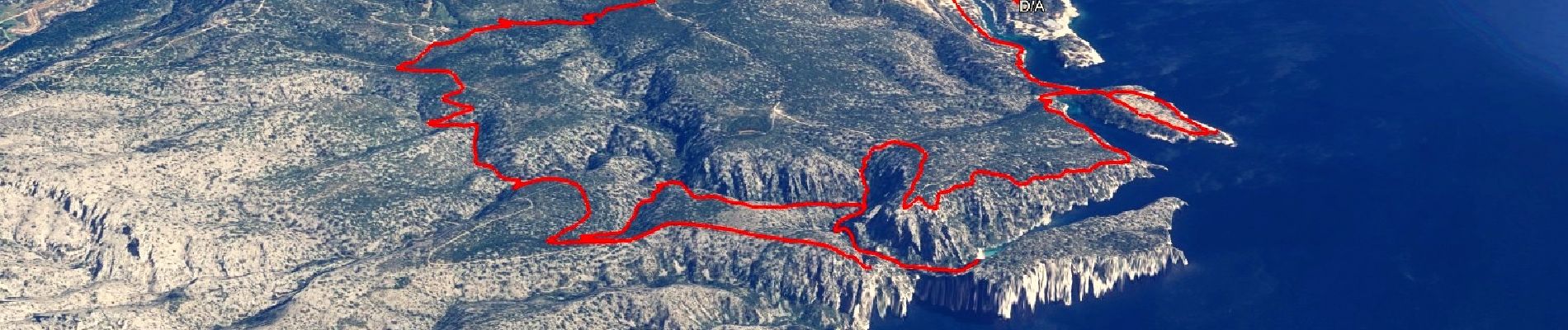
SityTrail - Les 3 Calanques - Cassis

affinetataille
User GUIDE
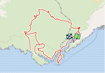

Length
16.6 km

Max alt
209 m

Uphill gradient
603 m
Km-Effort
25 km

Min alt
5 m

Downhill gradient
602 m
Boucle
Yes
Creation date :
2022-03-29 20:55:24.53
Updated on :
2022-04-15 18:13:10.014
6h00
Difficulty : Difficult

FREE GPS app for hiking
 SityTrail
IGN / Geographical institutes
SityTrail Plus
The world is yours!
About
Trail Walking of 16.6 km to be discovered at Provence-Alpes-Côte d'Azur, Bouches-du-Rhône, Cassis. This trail is proposed by affinetataille.
Photos


37 photos in total. Please click on a photo to see them all in the gallery.
Positioning
Country:
France
Region :
Provence-Alpes-Côte d'Azur
Department/Province :
Bouches-du-Rhône
Municipality :
Cassis
Location:
Unknown
Start:(Dec)
Start:(UTM)
704635 ; 4786889 (31T) N.
Comments