


Marmite de Lascours 31 mars 2022

rlebasque
User
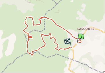

Length
12.7 km

Max alt
722 m

Uphill gradient
693 m
Km-Effort
22 km

Min alt
202 m

Downhill gradient
684 m
Boucle
No
Creation date :
2022-03-31 06:57:57.086
Updated on :
2022-03-31 13:38:39.875
6h40
Difficulty : Very difficult

FREE GPS app for hiking
 SityTrail
IGN / Geographical institutes
SityTrail Plus
The world is yours!
About
Trail Walking of 12.7 km to be discovered at Provence-Alpes-Côte d'Azur, Bouches-du-Rhône, Roquevaire. This trail is proposed by rlebasque.
Positioning
Country:
France
Region :
Provence-Alpes-Côte d'Azur
Department/Province :
Bouches-du-Rhône
Municipality :
Roquevaire
Location:
Unknown
Start:(Dec)
Start:(UTM)
708925 ; 4801822 (31T) N.
Comments