Trail Walking Sigoyer - Petite Ceüze - Photo
 Marco05
Marco05

User

© OpenStreetMap contributors
Length
Length
11.6 km
Max alt
Max alt
1662 m
Uphill gradient
Uphill gradient
750 m
Km-Effort
Km-Effort  
22 km
Min alt
Min alt
1115 m
Downhill gradient
Downhill gradient
756 m
Boucle
Boucle
Yes
Creation date :
2022-04-01 12:02:45.05
Updated on :
2022-11-14 12:17:04.327

(0 Reviews)

Walking
Walking
4h54
Difficulty : Medium

Scan this QR Code to open this trail in the SityTrail application

FREE GPS app for hiking

Logo SityTrail SityTrail

IGN / Geographical institutes

Download SityTrail from the App Store Download SityTrail from Google Play

Logo SityTrail SityTrail World

The world is yours!

Download SityTrail from the App Store Download SityTrail from Google Play Download SityTrail on Huawei AppGallery

About

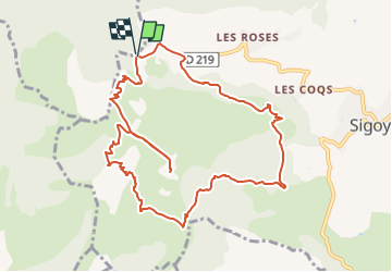
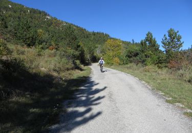
Trail Walking of 11.6 km to be discovered at Provence-Alpes-Côte d'Azur, Hautes-Alpes, Sigoyer. This trail is proposed by Marco05.

Description

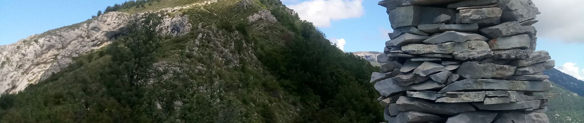
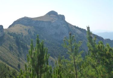
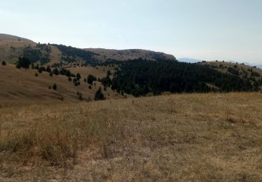
La petite Ceüze (ou bien Ceüzette) est un sommet bien visible de Gap, à gauche du massif de Ceüze.
Moins haute que sa grande sœur, elle vaut largement le déplacement pour des randonneurs moyens.
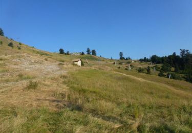
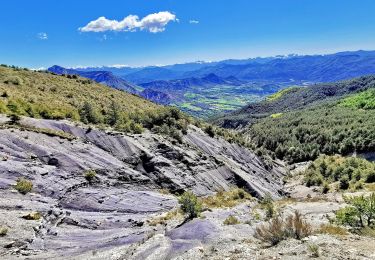
Le départ se fait du col des Guérins.
On peut faire l'aller-retour jusqu'au sommet, mais pour des randonneurs bien entrainés on peut faire une boucle par les ruines de Céas. C'est ce parcours que j'ai tracé.
Attention, pour le final du sommet une petite cheminée est à gravir.

Elevation profile

Photos

Positioning

Country:
France
Region :
Provence-Alpes-Côte d'Azur
Department/Province :
Hautes-Alpes
Municipality :
Sigoyer
Location:
Unknown
Start:(UTM)
733570 ; 4929949 (31T) N.

Trails nearby

Trail Walking Manteyer - R14   Pic de Ceuze - Photo
Walking
GUIDE+

Walking

Medium
(5)
Manteyer, Provence-Alpes-Côte d'Azur, Hautes-Alpes, France
9.6 km | 15.6 km-effort
4h 30min
Yes
Trail Mountain bike Manteyer - VTT32   aspremont - Photo
Mountain bike
GUIDE+

Mountain bike

Medium
(2)
Manteyer, Provence-Alpes-Côte d'Azur, Hautes-Alpes, France
21 km | 28 km-effort
2h 8min
No
Trail Mountain bike Châteauneuf-d'Oze - ceuse9 avril 2012 - Photo
Mountain bike
GUIDE
harydh

Mountain bike

Medium
(2)
Châteauneuf-d'Oze, Provence-Alpes-Côte d'Azur, Hautes-Alpes, France
18.1 km | 26 km-effort
Unknown
Yes
Trail Mountain bike Manteyer - VTT25 - Ceuse - Photo
Mountain bike
GUIDE+

Mountain bike

Medium
Manteyer, Provence-Alpes-Côte d'Azur, Hautes-Alpes, France
13.7 km | 23 km-effort
1h 27min
Yes
Trail Mountain bike Manteyer - VTT05 - Ceuze et Ceuzette - Photo
Mountain bike
GUIDE+

Mountain bike

Difficult
(1)
Manteyer, Provence-Alpes-Côte d'Azur, Hautes-Alpes, France
33 km | 47 km-effort
3h 20min
No
Trail Mountain bike Châteauneuf-d'Oze - VTT04 - Les balcons de Ceuze - Photo
Mountain bike
GUIDE+

Mountain bike

Medium
Châteauneuf-d'Oze, Provence-Alpes-Côte d'Azur, Hautes-Alpes, France
24 km | 37 km-effort
2h 15min
Yes
Trail Walking Manteyer - Tour de Ceüze - Photo
Walking
Marco05

Walking

Difficult
Manteyer, Provence-Alpes-Côte d'Azur, Hautes-Alpes, France
11.2 km | 20 km-effort
4h 34min
Yes
Trail Walking Sigoyer - Montee de la petite Ceüz - Photo
Walking
tyax93

Walking

Easy
Sigoyer, Provence-Alpes-Côte d'Azur, Hautes-Alpes, France
3 km | 6.8 km-effort
1h 27min
No
Trail Walking Esparron - Montagne de Rochefort via Esparron - Photo
Walking
PapouBertrand

Walking

Very difficult
Esparron, Provence-Alpes-Côte d'Azur, Hautes-Alpes, France
12.6 km | 24 km-effort
6h 12min
Yes


Close
My subscriptions