


Voies de nos ancetres depart Serres +168

claude nier
User

Length
7 km

Max alt
770 m

Uphill gradient
168 m
Km-Effort
9.3 km

Min alt
639 m

Downhill gradient
171 m
Boucle
Yes
Creation date :
2022-04-02 10:53:18.911
Updated on :
2022-04-02 10:54:42.698
2h06
Difficulty : Easy

FREE GPS app for hiking
 SityTrail
IGN / Geographical institutes
SityTrail Plus
The world is yours!
About
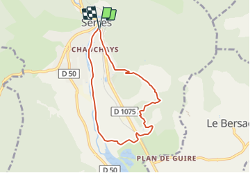
Trail On foot of 7 km to be discovered at Provence-Alpes-Côte d'Azur, Hautes-Alpes, Serres. This trail is proposed by claude nier.
Description
petite rando sympatique
Positioning
Country:
France
Region :
Provence-Alpes-Côte d'Azur
Department/Province :
Hautes-Alpes
Municipality :
Serres
Location:
Unknown
Start:(Dec)
Start:(UTM)
716320 ; 4923069 (31T) N.
Comments