


Boucle de Ste Grique depart Lagrand +499

claude nier
User
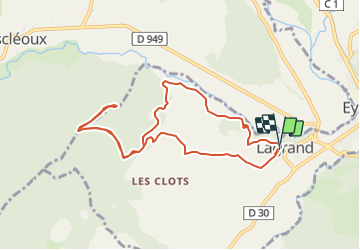

Length
9.9 km

Max alt
1070 m

Uphill gradient
499 m
Km-Effort
16.5 km

Min alt
614 m

Downhill gradient
499 m
Boucle
Yes
Creation date :
2022-04-02 11:20:33.508
Updated on :
2022-04-02 11:21:32.267
3h45
Difficulty : Difficult

FREE GPS app for hiking
 SityTrail
IGN / Geographical institutes
SityTrail Plus
The world is yours!
About
Trail Walking of 9.9 km to be discovered at Provence-Alpes-Côte d'Azur, Hautes-Alpes, Garde-Colombe. This trail is proposed by claude nier.
Description
rando a decouvrir... sympa
Positioning
Country:
France
Region :
Provence-Alpes-Côte d'Azur
Department/Province :
Hautes-Alpes
Municipality :
Garde-Colombe
Location:
Unknown
Start:(Dec)
Start:(UTM)
719633 ; 4913431 (31T) N.
Comments