Trou du Diable depart Clastre 658 +

claude nier
User
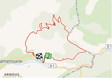

Length
11.3 km

Max alt
1354 m

Uphill gradient
658 m
Km-Effort
20 km

Min alt
708 m

Downhill gradient
664 m
Boucle
Yes
Creation date :
2022-04-03 16:39:30.28
Updated on :
2022-04-03 16:40:41.369
4h34
Difficulty : Very difficult

FREE GPS app for hiking
 SityTrail
IGN / Geographical institutes
SityTrail Plus
The world is yours!
About
Trail Walking of 11.3 km to be discovered at Provence-Alpes-Côte d'Azur, Alpes-de-Haute-Provence, Clamensane. This trail is proposed by claude nier.
Description
jolie panorama
Positioning
Country:
France
Region :
Provence-Alpes-Côte d'Azur
Department/Province :
Alpes-de-Haute-Provence
Municipality :
Clamensane
Location:
Unknown
Start:(Dec)
Start:(UTM)
267778 ; 4911671 (32T) N.
Comments