


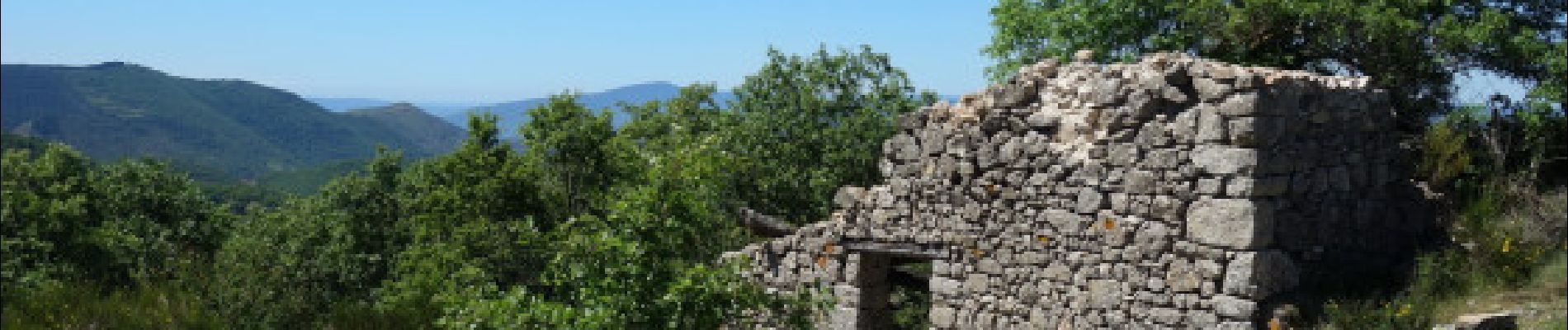
Le col des Fosses et La Rouvrière au départ de Colognac

ARVIEU
User
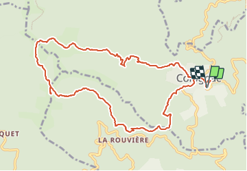

Length
11.7 km

Max alt
901 m

Uphill gradient
438 m
Km-Effort
17.5 km

Min alt
552 m

Downhill gradient
435 m
Boucle
Yes
Creation date :
2022-04-05 09:39:54.083
Updated on :
2022-04-05 09:42:44.459
5h00
Difficulty : Difficult

FREE GPS app for hiking
 SityTrail
IGN / Geographical institutes
SityTrail Plus
The world is yours!
About
Trail Walking of 11.7 km to be discovered at Occitania, Gard, Colognac. This trail is proposed by ARVIEU.
Photos

Points of interest


Positioning
Country:
France
Region :
Occitania
Department/Province :
Gard
Municipality :
Colognac
Location:
Unknown
Start:(Dec)
Start:(UTM)
566317 ; 4875128 (31T) N.
Comments