


Asptt SAHUNE VILLEPERDRIX

TOULAUDIN
User
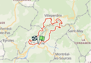

Length
16.5 km

Max alt
719 m

Uphill gradient
792 m
Km-Effort
27 km

Min alt
354 m

Downhill gradient
794 m
Boucle
Yes
Creation date :
2022-04-05 08:01:12.362
Updated on :
2022-04-16 16:33:45.091
6h29
Difficulty : Difficult

FREE GPS app for hiking
 SityTrail
IGN / Geographical institutes
SityTrail Plus
The world is yours!
About
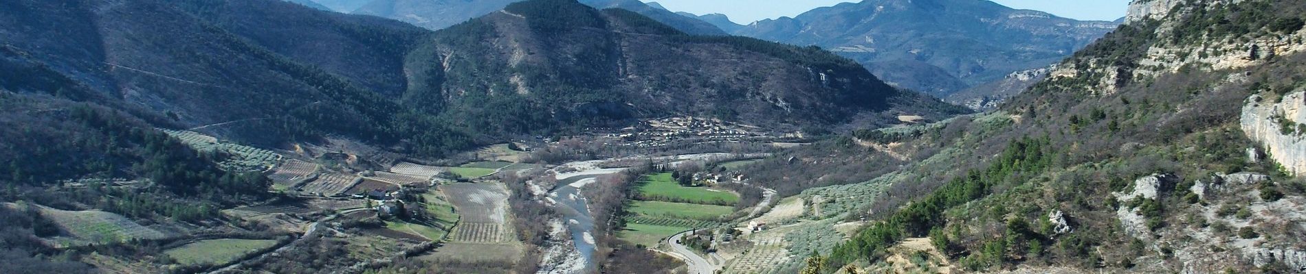
Trail Walking of 16.5 km to be discovered at Auvergne-Rhône-Alpes, Drôme, Sahune. This trail is proposed by TOULAUDIN.
Description
trace réalisée le 5/4/22 lors de la rando. attention qq passage hors sentier
parfois sentier étroit ,être vigilant à la descente
Photos


Positioning
Country:
France
Region :
Auvergne-Rhône-Alpes
Department/Province :
Drôme
Municipality :
Sahune
Location:
Unknown
Start:(Dec)
Start:(UTM)
680502 ; 4920354 (31T) N.
Comments