


luminy

jmheydorff
User

Length
63 km

Max alt
498 m

Uphill gradient
2762 m
Km-Effort
100 km

Min alt
-3 m

Downhill gradient
2828 m
Boucle
No
Creation date :
2022-04-08 07:52:18.199
Updated on :
2022-04-08 18:25:33.63
3h01
Difficulty : Very difficult

FREE GPS app for hiking
 SityTrail
IGN / Geographical institutes
SityTrail Plus
The world is yours!
About
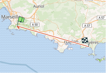
Trail Walking of 63 km to be discovered at Provence-Alpes-Côte d'Azur, Bouches-du-Rhône, Marseille. This trail is proposed by jmheydorff.
Positioning
Country:
France
Region :
Provence-Alpes-Côte d'Azur
Department/Province :
Bouches-du-Rhône
Municipality :
Marseille
Location:
9th Arrondissement
Start:(Dec)
Start:(UTM)
697508 ; 4789368 (31T) N.
Comments