


Col de Fenestre - Pas de Ladre - Cime de l'Agnellière
© OpenStreetMap contributors


6h52
Difficulty : Medium


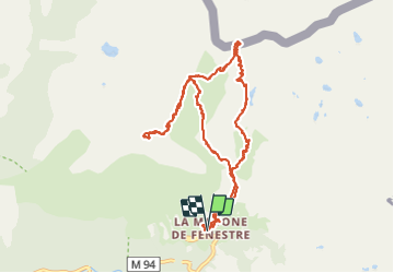
Length
14.5 km
Max alt
2638 m
Uphill gradient
886 m
Km-Effort
26 km
Min alt
1895 m
Downhill gradient
887 m
Boucle
Yes
Creation date :
2014-12-10 00:00:00.0
Updated on :
2014-12-10 00:00:00.0
6h52
Difficulty : Medium
FREE GPS app for hiking
 SityTrail
IGN / Geographical institutes
SityTrail Plus
The world is yours!
About
Trail Walking of 14.5 km to be discovered at Provence-Alpes-Côte d'Azur, Maritime Alps, Saint-Martin-Vésubie. This trail is proposed by jean.marie.litzler@gmail.com.
Description
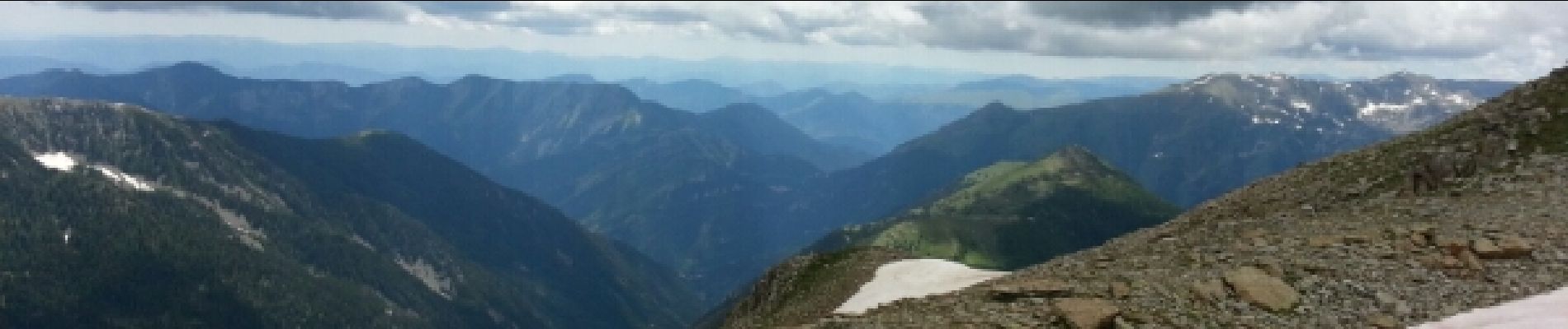
Magnifiques paysages - Italie de Fenestre - Canne et Nice depuis L'Agnellière.
Photos


29 photos in total. Please click on a photo to see them all in the gallery.
Positioning
Country:
France
Region :
Provence-Alpes-Côte d'Azur
Department/Province :
Maritime Alps
Municipality :
Saint-Martin-Vésubie
Location:
Unknown
Start:(Dec)
Start:(UTM)
368383 ; 4883774 (32T) N.
Comments