


tamee

jphugon
User
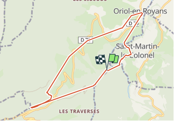

Length
9.3 km

Max alt
712 m

Uphill gradient
519 m
Km-Effort
16.3 km

Min alt
277 m

Downhill gradient
537 m
Boucle
Yes
Creation date :
2022-04-10 07:47:52.989
Updated on :
2022-04-10 14:25:37.194
6h37
Difficulty : Difficult

FREE GPS app for hiking
 SityTrail
IGN / Geographical institutes
SityTrail Plus
The world is yours!
About
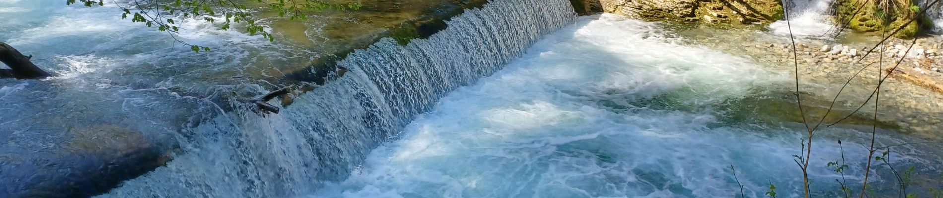
Trail Walking of 9.3 km to be discovered at Auvergne-Rhône-Alpes, Drôme, Oriol-en-Royans. This trail is proposed by jphugon.
Photos

Positioning
Country:
France
Region :
Auvergne-Rhône-Alpes
Department/Province :
Drôme
Municipality :
Oriol-en-Royans
Location:
Unknown
Start:(Dec)
Start:(UTM)
678346 ; 4983436 (31T) N.
Comments