Trail Walking Mazerier - Les collines de Mazerier  - Photo

Les collines de Mazerier

 Gegetop
Gegetop

User

© OpenStreetMap contributors
Length
Length
14.1 km
Max alt
Max alt
458 m
Uphill gradient
Uphill gradient
220 m
Km-Effort
Km-Effort  
17 km
Min alt
Min alt
332 m
Downhill gradient
Downhill gradient
223 m
Boucle
Boucle
Yes
Creation date :
2022-04-11 09:42:48.09
Updated on :
2022-04-11 13:44:41.298

(1 Reviews)

Walking
Walking
3h23
Difficulty : Medium

Scan this QR Code to open this trail in the SityTrail application

FREE GPS app for hiking

Logo SityTrail SityTrail

IGN / Geographical institutes

Download SityTrail from the App Store Download SityTrail from Google Play

Logo SityTrail SityTrail World

The world is yours!

Download SityTrail from the App Store Download SityTrail from Google Play Download SityTrail on Huawei AppGallery

About

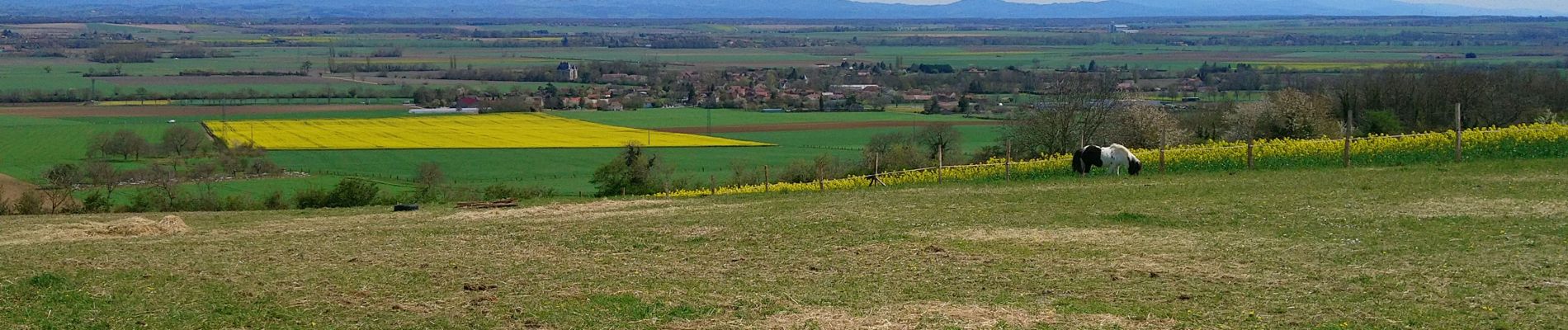
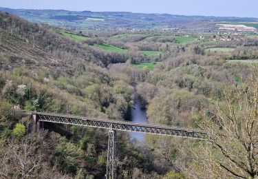
Trail Walking of 14.1 km to be discovered at Auvergne-Rhône-Alpes, Allier, Mazerier. This trail is proposed by Gegetop.

Description

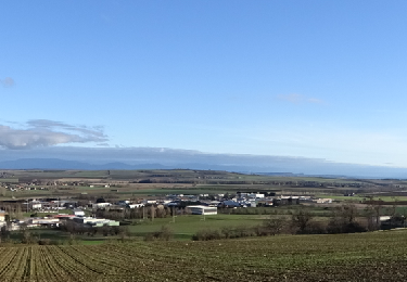
PR. 15 légèrement modifié sur les 3 derniers km.

Elevation profile

Photos

Positioning

Country:
France
Region :
Auvergne-Rhône-Alpes
Department/Province :
Allier
Municipality :
Mazerier
Location:
Unknown
Start:(UTM)
514676 ; 5107980 (31T) N.

Comments

Please log in to post a review or rate the element


Trails nearby

Trail Running Gannat - jour 10 CAP Jeanot - Photo
Running
jeannat

Running

Very easy
Gannat, Auvergne-Rhône-Alpes, Allier, France
31 km | 40 km-effort
3h 59min
No
Trail Walking Gannat - Gannat - Photo
Walking
guy63

Walking

Medium
Gannat, Auvergne-Rhône-Alpes, Allier, France
7.5 km | 9.1 km-effort
2h 40min
Yes
Trail Hybrid bike Gannat - jour 10 - Photo
Hybrid bike
nathbab

Hybrid bike

Very easy
Gannat, Auvergne-Rhône-Alpes, Allier, France
31 km | 38 km-effort
2h 40min
No
Trail Walking Mazerier - Maziere 03 - Photo
Walking
raypat

Walking

Very easy
Mazerier, Auvergne-Rhône-Alpes, Allier, France
14.4 km | 17.4 km-effort
3h 20min
Yes
Trail Walking Saint-Bonnet-de-Rochefort - les tressots - Photo
Walking
patrickboisard

Walking

Medium
Saint-Bonnet-de-Rochefort, Auvergne-Rhône-Alpes, Allier, France
6.6 km | 8.6 km-effort
1h 37min
Yes
Trail Walking Saint-Bonnet-de-Rochefort - Randonnée organisée  - Photo
Walking
Vincent Bicard

Walking

Medium
Saint-Bonnet-de-Rochefort, Auvergne-Rhône-Alpes, Allier, France
6.1 km | 7 km-effort
1h 40min
Yes
Trail sport Gannat - Gannat 1 - Photo
sport
jeriom

sport

Very easy
Gannat, Auvergne-Rhône-Alpes, Allier, France
5.5 km | 7.5 km-effort
Unknown
Yes
Trail Mountain bike Jenzat - vtt - Photo
Mountain bike
ricodal

Mountain bike

Medium
Jenzat, Auvergne-Rhône-Alpes, Allier, France
16.6 km | 21 km-effort
1h 30min
No
Trail Walking Saint-Bonnet-de-Rochefort - Saint Bonnet de Rochefort - Photo
Walking
jpblimond

Walking

Medium
Saint-Bonnet-de-Rochefort, Auvergne-Rhône-Alpes, Allier, France
19.7 km | 25 km-effort
5h 5min
Yes


Close
My subscriptions