


plo de Berdaoulou

chrisgps
User
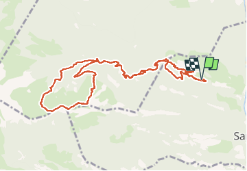

Length
12.9 km

Max alt
1774 m

Uphill gradient
1010 m
Km-Effort
26 km

Min alt
790 m

Downhill gradient
1012 m
Boucle
Yes
Creation date :
2022-04-14 06:56:04.218
Updated on :
2022-07-03 15:27:40.886
7h12
Difficulty : Medium

FREE GPS app for hiking
 SityTrail
IGN / Geographical institutes
SityTrail Plus
The world is yours!
About
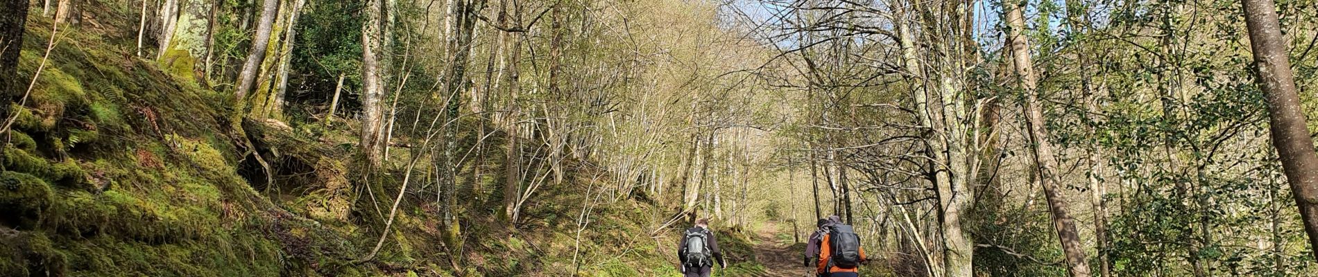
Trail Walking of 12.9 km to be discovered at Occitania, Hautespyrenees, Sarrancolin. This trail is proposed by chrisgps.
Description
avec boucle au sommet
Photos


Positioning
Country:
France
Region :
Occitania
Department/Province :
Hautespyrenees
Municipality :
Sarrancolin
Location:
Unknown
Start:(Dec)
Start:(UTM)
285001 ; 4761648 (31T) N.
Comments