


F05 Monetier Roche Noire Clarée Fruitière

ageo
User

Length
15.6 km

Max alt
2657 m

Uphill gradient
1186 m
Km-Effort
30 km

Min alt
1494 m

Downhill gradient
811 m
Boucle
No
Creation date :
2017-06-06 00:00:00.0
Updated on :
2017-06-06 00:00:00.0
6h34
Difficulty : Difficult

FREE GPS app for hiking
 SityTrail
IGN / Geographical institutes
SityTrail Plus
The world is yours!
About
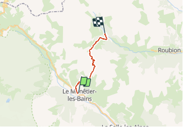
Trail Walking of 15.6 km to be discovered at Provence-Alpes-Côte d'Azur, Hautes-Alpes, Le Monêtier-les-Bains. This trail is proposed by ageo.
Description
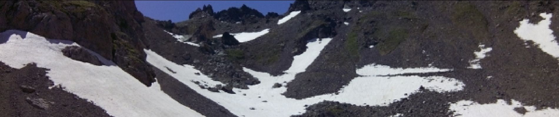
Avec GJ. Passage du col dur à trouver et difficile.
Photos


Positioning
Country:
France
Region :
Provence-Alpes-Côte d'Azur
Department/Province :
Hautes-Alpes
Municipality :
Le Monêtier-les-Bains
Location:
Unknown
Start:(Dec)
Start:(UTM)
303576 ; 4983485 (32T) N.
Comments