Trail Walking Cruseilles - 15-04-2022 Les Dronières - Plan du Salève  - Photo

15-04-2022 Les Dronières - Plan du Salève

 Kargil
Kargil

User GUIDE

© OpenStreetMap contributors
Length
Length
18.6 km
Max alt
Max alt
1338 m
Uphill gradient
Uphill gradient
658 m
Km-Effort
Km-Effort  
27 km
Min alt
Min alt
778 m
Downhill gradient
Downhill gradient
653 m
Boucle
Boucle
Yes
Creation date :
2022-04-15 08:33:01.612
Updated on :
2022-04-15 16:07:44.998

(0 Reviews)

Walking
Walking
4h31
Difficulty : Medium

Scan this QR Code to open this trail in the SityTrail application

FREE GPS app for hiking

Logo SityTrail SityTrail

IGN / Geographical institutes

Download SityTrail from the App Store Download SityTrail from Google Play

Logo SityTrail SityTrail World

The world is yours!

Download SityTrail from the App Store Download SityTrail from Google Play Download SityTrail on Huawei AppGallery

About

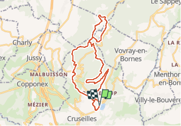
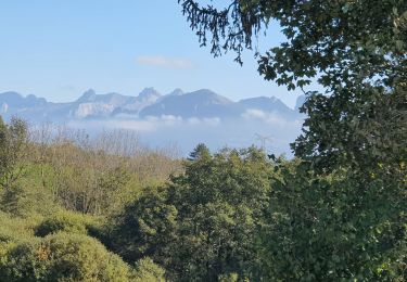
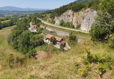
Trail Walking of 18.6 km to be discovered at Auvergne-Rhône-Alpes, Upper Savoy, Cruseilles. This trail is proposed by Kargil.

Description

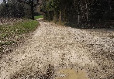
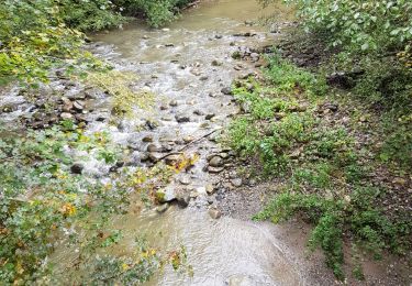
Au kilomètre 10, longer la lisière du bois et la clôture côté prairie

Elevation profile

Photos

Positioning

Country:
France
Region :
Auvergne-Rhône-Alpes
Department/Province :
Upper Savoy
Municipality :
Cruseilles
Location:
Unknown
Start:(UTM)
277261 ; 5102525 (32T) N.

Trails nearby

Trail Nordic walking Groisy - Groisy Nérulaz Les Pesses Fontaine vive - Photo
Nordic walking
Petitchaperonvert

Nordic walking

Very easy
(1)
Groisy, Auvergne-Rhône-Alpes, Upper Savoy, France
9.1 km | 11.6 km-effort
Unknown
Yes
Trail Walking Présilly - 27-04-2022 Maison et Plan du Salève-Mont Sion  - Photo
Walking
GUIDE
Kargil

Walking

Difficult
Présilly, Auvergne-Rhône-Alpes, Upper Savoy, France
20 km | 32 km-effort
5h 15min
Yes
Trail Walking Menthonnex-en-Bornes - Tour du plateau ds bornes - Photo
Walking
Nico222

Walking

Easy
(2)
Menthonnex-en-Bornes, Auvergne-Rhône-Alpes, Upper Savoy, France
11.6 km | 15 km-effort
3h 12min
Yes
Trail Walking Cruseilles - becon - Photo
Walking
zanipolo0449

Walking

Easy
Cruseilles, Auvergne-Rhône-Alpes, Upper Savoy, France
4.4 km | 5.8 km-effort
1h 18min
Yes
Trail Walking Allonzier-la-Caille - 18-03-2022 Ponts de la Caille - Creux de Vallières - Photo
Walking
GUIDE
Kargil

Walking

Medium
Allonzier-la-Caille, Auvergne-Rhône-Alpes, Upper Savoy, France
25 km | 35 km-effort
5h 47min
Yes
Trail Walking Cruseilles - suet - Photo
Walking
zanipolo0449

Walking

Easy
Cruseilles, Auvergne-Rhône-Alpes, Upper Savoy, France
4.5 km | 5.7 km-effort
1h 27min
Yes
Trail Walking Menthonnex-en-Bornes - Tour du plateau des Bornes  - Photo
Walking
GUIDE
Kargil

Walking

Medium
Menthonnex-en-Bornes, Auvergne-Rhône-Alpes, Upper Savoy, France
20 km | 27 km-effort
4h 28min
Yes
Trail Walking Menthonnex-en-Bornes - Massif des Bornes_04-10-2020 - Photo
Walking
GUIDE
Kargil

Walking

Easy
Menthonnex-en-Bornes, Auvergne-Rhône-Alpes, Upper Savoy, France
9.5 km | 12.8 km-effort
2h 16min
Yes
Trail Walking Cruseilles - au dessus de cruseilles - Photo
Walking
zanipolo0449

Walking

Easy
Cruseilles, Auvergne-Rhône-Alpes, Upper Savoy, France
1.4 km | 1.7 km-effort
23min
Yes


Close
My subscriptions